Exploring the notorious Bidwill bush

Today we have a rather unusual material that would be better off if it was published by some pseudo-urban-exploration-youtube-channel where a bunch of local teenagers get together looking for a place to bike, parkour, smoke a joint and annoy old people from local households, filming all the said experiences on their "vintage effect" cameras.

And I can't blame those people. Growing up in Eastern European semi-countryside on the outskirts of my hometown, I've done my fair share of exploration: sketchy bushes, abandoned buildings and just weird-ass concrete structures.
Haunted by flashbacks of my past experiences as a curious teenager who couldn't stop wandering around, I would always do the same thing wherever life takes me. Finally, life took me to a brand new housing estate in a suburb of Marsden Park, north west of Sydney. Keen to explore what lies on the southern end of a suburb and not being familiar with a peculiarity of Western Sydney areas, I found myself in one of the dodgiest places in the whole Sydney.
Table of contents
Background
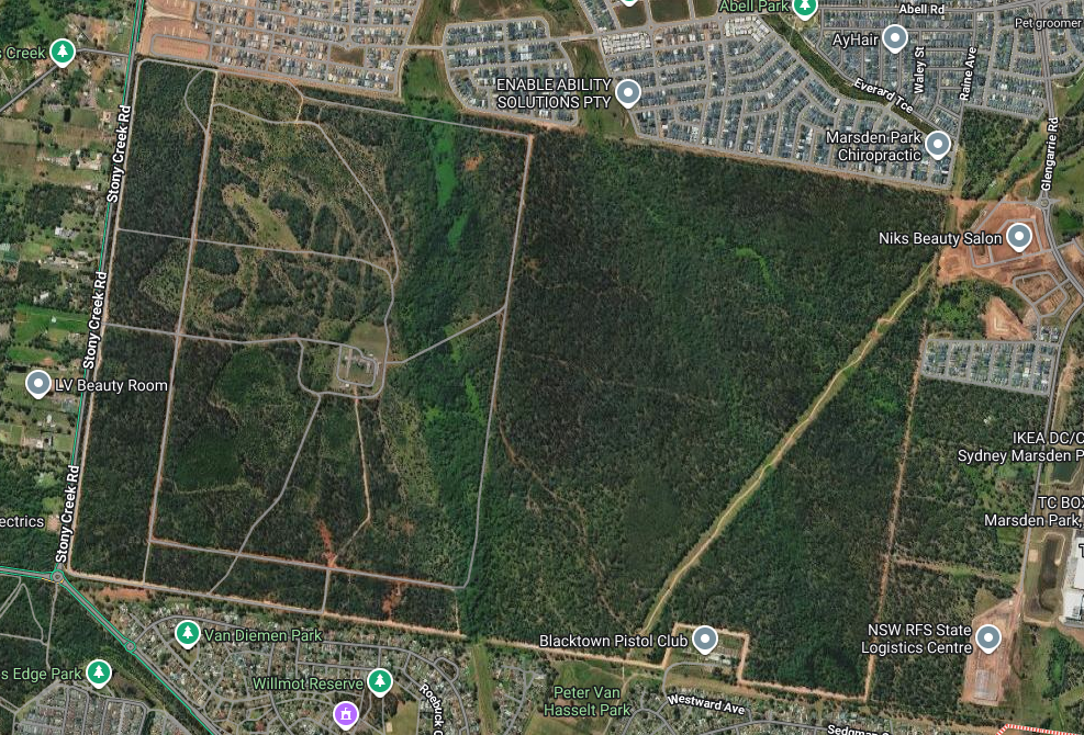
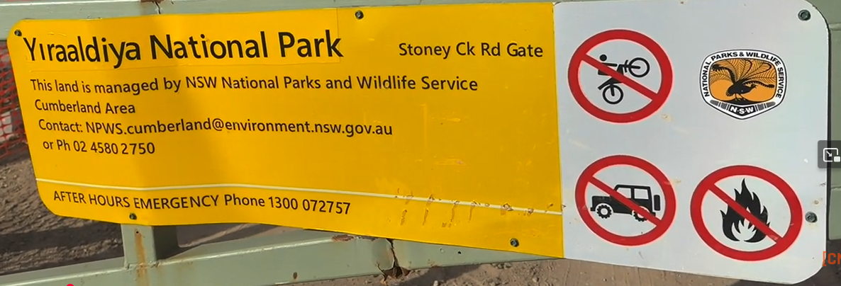
The so-called Bidwill bush, aka Shanes Park Reserve, aka Red Road , aka Yiraaldiya National Park (since NPWS began converting it to national park), is a rectangularly-shaped piece of land primarily consisted of bush (who would've thought?), swamps, trails and small creeks.
It's an interesting piece of land from geographical standpoint being the reason it was chosen to be turned into a national park:
The Park is a bushland remnant in quite good condition and many interesting plants and animals can be found there still.
Yiraaldiya is the only site in Greater Sydney included in NSW’s feral‑predator‑free network and the first fully fenced rewilding reserve within a major Australian city.
Besides acting as a nature's reserve, this bush has some stories to tell. But first let's see what's going on around the area and what's so special about this soon-to-be a national park. It's not just another bush on the outskirts of Sydney, right?
North side
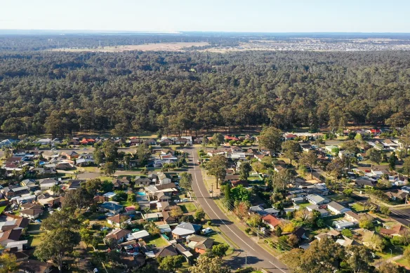
On its north end Bidwill bush borders brand new estates of Melonba and Elara (aka Marsden Park). 10 years ago there wasn't much happening here - bush, mud and old farms was all one could find. One Uber driver, who allegedly grew up here, told me that 30 years ago he was coming to one of these farms to buy milk. Now that farm is nowhere to be found. Probably turned into a street with half a dozen new houses.
West side
To the west of Bidwill bush is Stony Creek Rd which separates it from vast farmlands of semi-rural suburb of Shanes Park - an area very typical for Sydney north-west. Big houses and farms with large acreages.
Although this bushland technically belongs to Shanes Park area (hence its former official name - Shanes Park Reserve), I'll be referring to it as Bidwill bush because I've heard this name circulating amongst locals. And also it makes things more mysterious and pretentious which is exactly what I need for this article.
East side
To the east of the bush we have one or two old farms that create a "natural" border between Bidwill bush and South Street followed by an industrial part of Marsden Park further east:
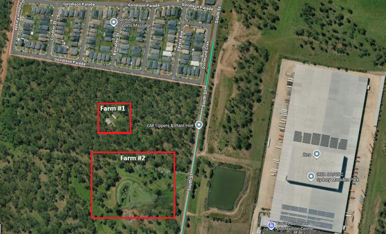
These farms are an interesting local artifact. Locals who saw this area as early as 1980s told me stories about one of them farms being owned by a man with one leg, locally known as pegleg. According to said locals, back in their glory days they would ride their bikes from Shalvey (south of the bush) along the trail (formerly known as Red Road; now Warbler Firetrail) into a farmland just for lulz. Pegleg, who at the time lived there full time, would get slightly upset by a fact that his bush retreat is getting occupied by local teenage idiots. Therefore he would load his gun with salt and start chasing those kids out of his property. Quote:
He used to shoot salt pellets at the bike riders stirring him up as he chased them.
I find it hard to picture in my head: trying to chase a bunch of kids across muddy bushland while having an implant instead of a leg while carrying a gun.

What can I say? Those days people were built differently. Not like modern vape-sucking energy-drink-guzzling vintage-effect-abusing generation. [old-fart-mode-off]
I'm not sure if these farms belong to the same owner. Or even if pegleg is still around because it's been at least 40 years since those events took place. Whoever owns them, it's apparent that they are reluctant to sell the land even after getting surrounded by brand new estates, effectively acting as the old farmlands final boss not willing to get conquered by building developers. One could imagine they get offered substantial amounts of money because with the population growth and urbanization of rural areas all across Sydney these acreages seem like a low-hanging fruit for construction companies (or whoever buys the land in the first place, I'm not sure who exactly is involved in this process at what stage).
South side
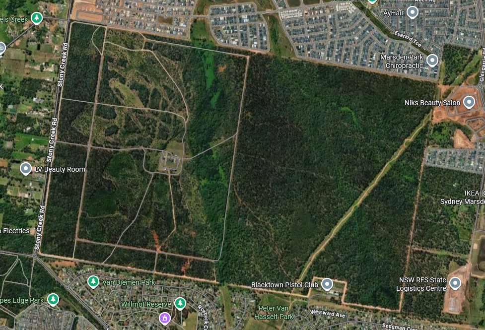
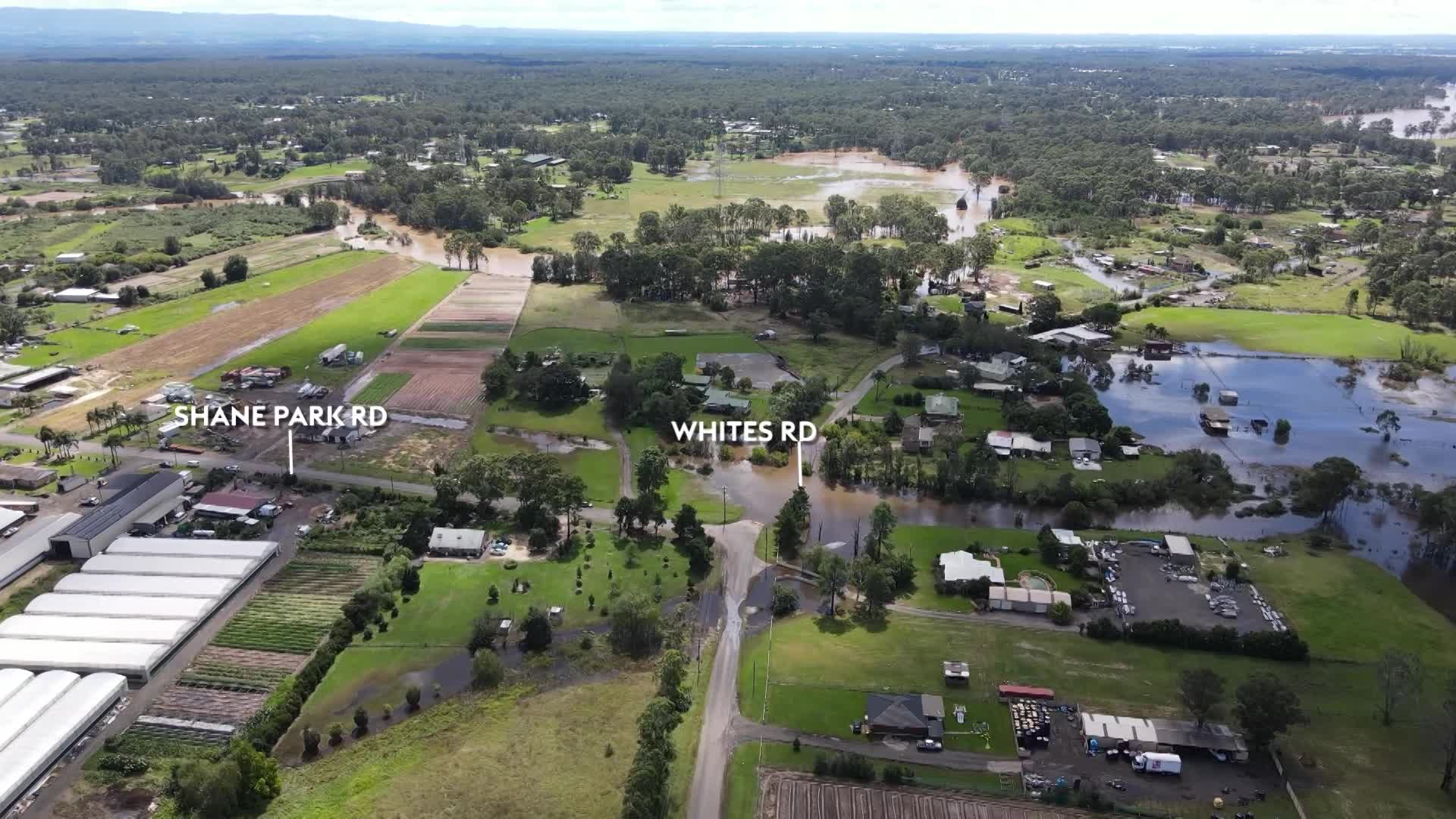
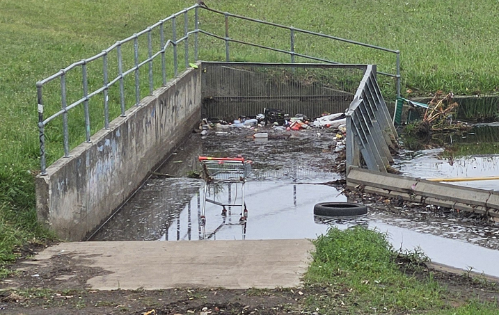
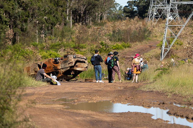
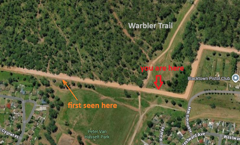
And of course let's look at the southernmost (and the sketchiest) border of this bush:
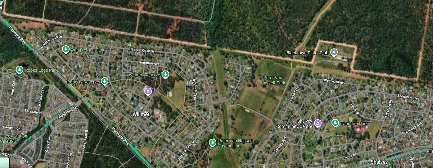
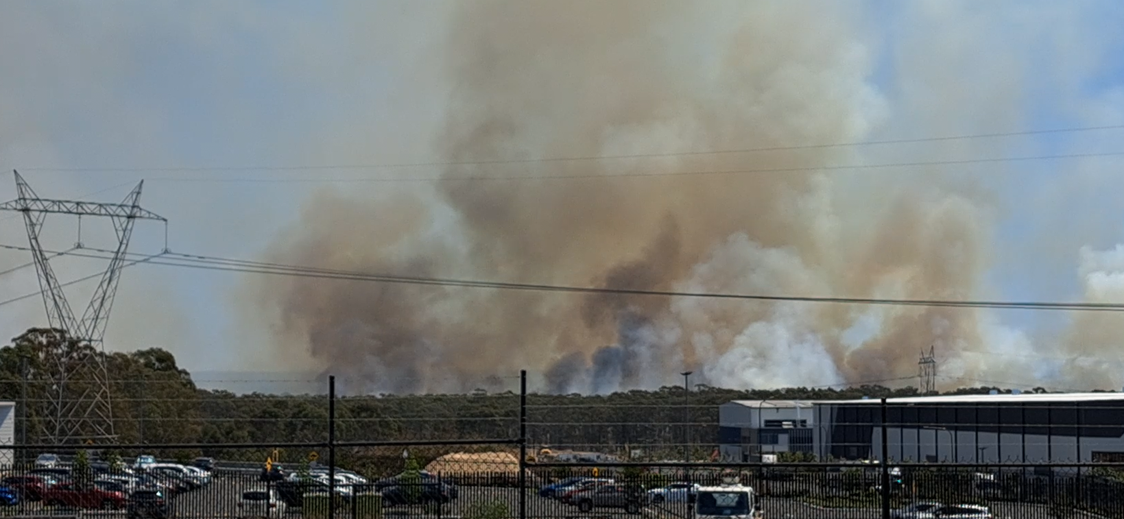
Let's stop here for a minute because I have a lot to tell. Top right in the picture is a shooting range called Blacktown Pistol Club, famous amongst locals. When someone is shooting in the air for fun practicing at the range, gunshots can be heard as far as on the other side of the bush. Moving south from a Pistol Club, we'll bump into suburbs of Willmot, Shalvey, Tregear and Bidwill (hence the name of the bush). These places have bad reputation amongst Sydney dwellers primarily due to high levels of criminal acrivity, unemployment and just plainly big amount of strange characters who happen to live there:
In recent times, Bidwill has been associated with social and economic problems. These have resulted in an increase of crime and such trouble as riots. It is known for drug use, violence, mental illness and poverty.
Please don't take it the wrong way - the above statement does not apply to all residents of those suburbs. Like everywhere, there's good and bad people. It's just the general vibe that those areas create - ask anyone who lives in Sydney west and they will likely confirm this.
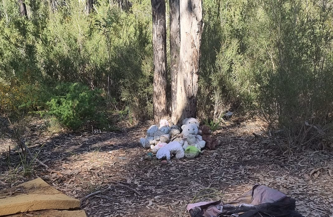
This bush has its dark secrets. One story that stands out and is particularly interesting when we talk about Bidwill bush is the chilling case of Kiesha's Weippeart murder:
Six year old Keisha was reported missing in August 2010. Her remains were found in bushland in Shalvey, in Sydney's west, in April 2011. Ms Abrahams, Keisha's mother and her stepfather, Robert Smith were arrested on the same day the body was found.
What referred to as bushland in Shalvey is the very same bush we're discussing in this article. After the body was discovered an improvised memorial was created on the same spot:
I accidentally heard of this case from a guy who grew up in Mt Druitt, but frankly didn't believe it thinking it's some kind of a local bogeyman story. When I looked it up I was rather stunned. Now it made sense why most locals express very mixed feelings when talking about the bush and adjacent suburbs.
Another local artifact discovered by Elara residents (they like to call themselved "elarians" which sounds ridiculous if you ask me) have also discovered what looks like someone's bush-dwelling cubby:
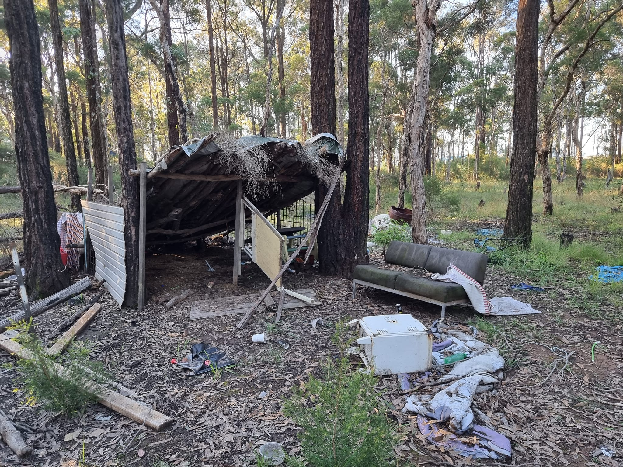
Most likely built and casually inhabitated by local teenagers as a place to do drugs and drink alcohol to hang out. But nevertheless, when you see this type of thing it often tells you something about local demographic. Speaking of which:
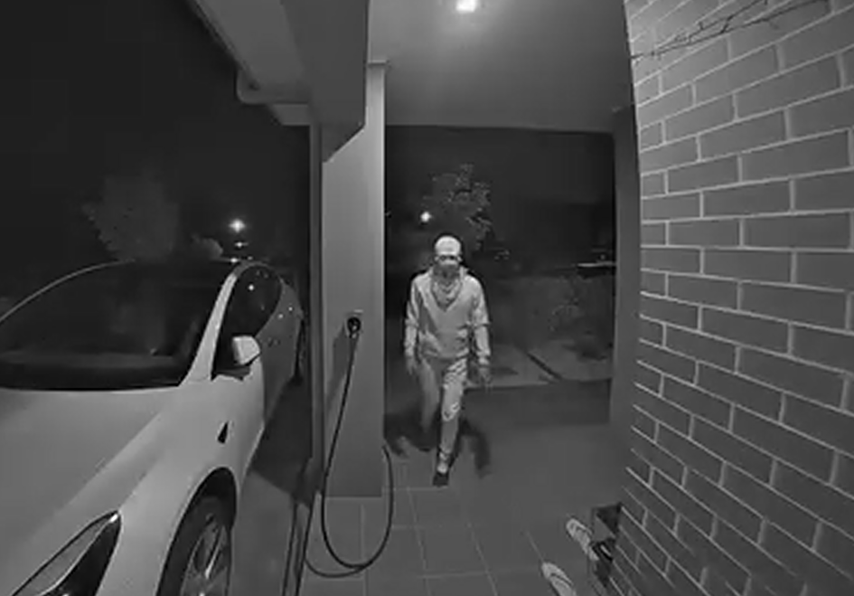
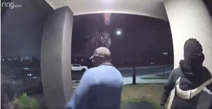
And this is what happened earlier this year:
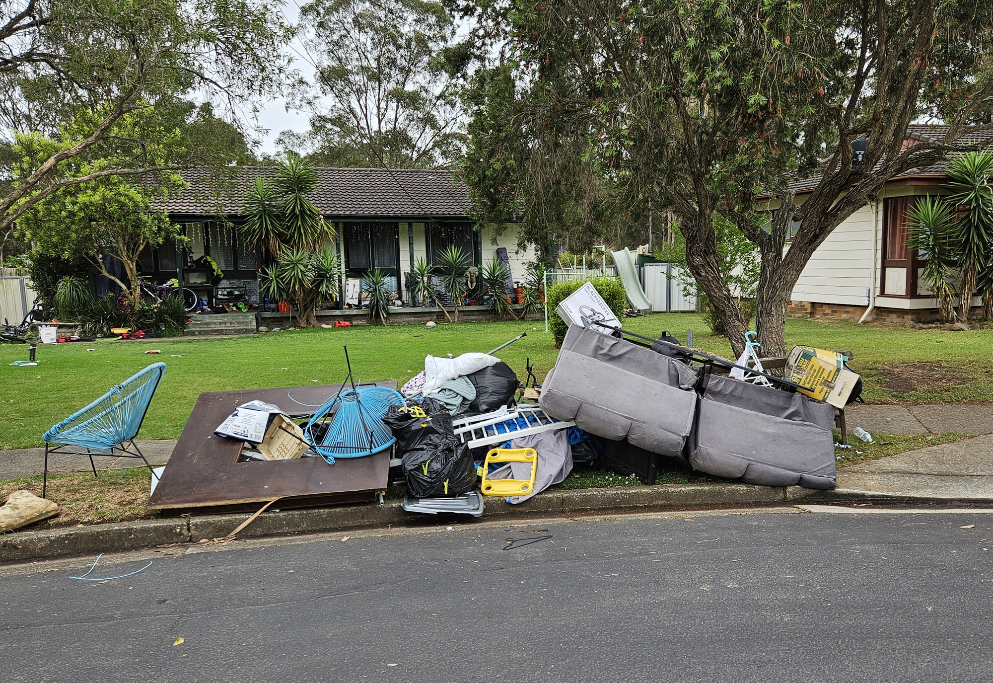
How is this related to Bidwill bush? It's commonly assumed that these low-life characters who are prone to disturbing the community at night are mostly coming for a visit from Bidwill, Shalvey and other suburbs to the south of the bush. Looking at the map, it's very convenient for them to make their way across the area, commit a bit of illicit activity and safely retreat without even being spotted:
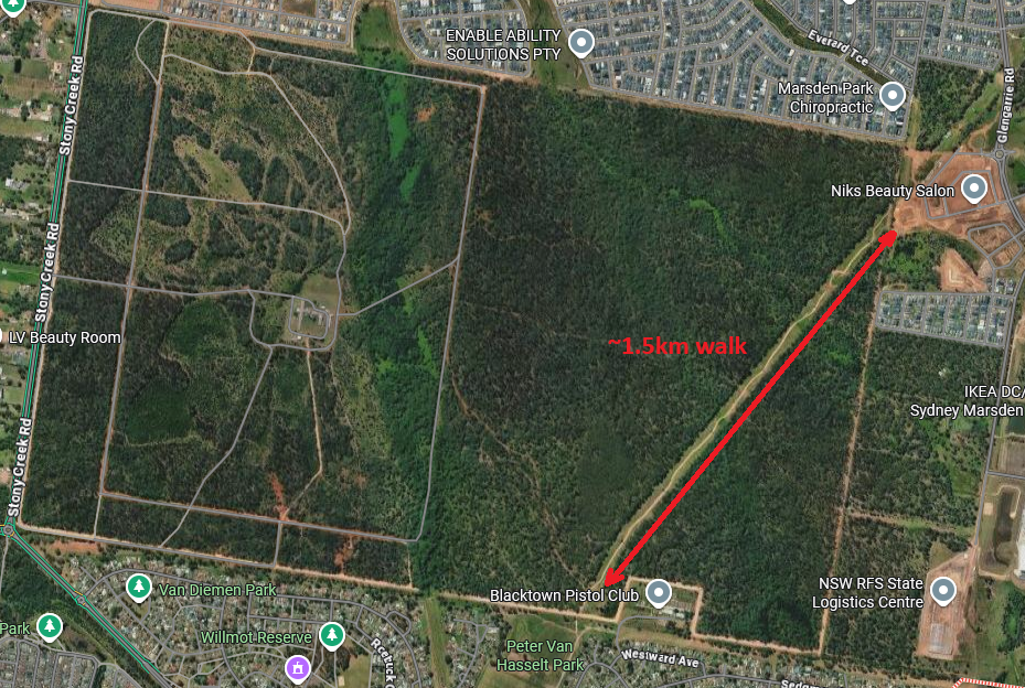
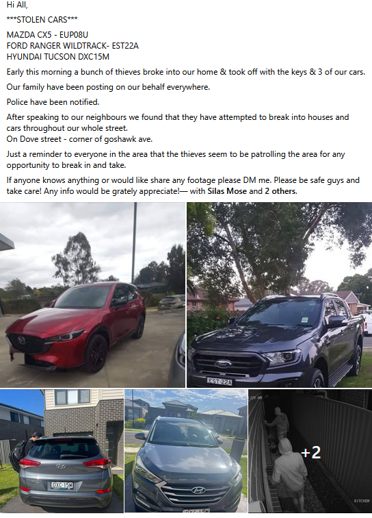
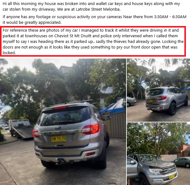
That illicit activity often involves breaking into houses and stealing goods. As a partial proof of that, Melonba resident who had their car stolen claimed it was found on the same day in the housing commision area of Mt Druitt (5 min drive from Bidwill) via tracking device:
What's the cause of this criminal activity? Elara, due to being mostly populated by normal middle-class people who can afford a new house and a nice car, became an attractive target for different types of thugs. This is not a rich suburb by Sydney standards, even if you compare it to neighbourhoods in Hills District just 20 minutes away, nevermind rich waterfront suburbs. However, it's deemed to be a "fancy area" compared to everything else in close proximity, hence the spike in criminal activity.
There's also other areas nearby that contain heavy percentage of dropkicks in its population. But due to having a convenient way of getting to Elara and back in a form of Bidwill bush trail - Willmot, Shalvey, Tregear and Bidwill are the most probable candidates for supplying low-life scumbags and certainly take the cake in that regard. Also, these suburbs were featured in one of Spanian's vlogs if you're a fan of that type of content.
This is what you need to know about south end of Bidwill bush. Hopefully it gives you a good perspective on what is going in the area and what kind of criminal-minded creatures you can come across.
That's the criminal part. But what else is in the bush worth exploring?
Mysterious area at the heart of the bush
Careful reader might remember that I only wandered into this bush by accident. I made several expeditions into the area which took me all the way to Peter Van Hasselt Park and a nearby shooting range. Since then I became very curious about the place because it reminded me how I was exploring my local bush back in my hometown 20 years ago. At the same time I was reluctant to go back and finish my exploration to discover 100% of the map after bumping into several sketchy characters in the bush who were seemingly unhappy with my presence. As I stopped visiting, my interest of the place has gradually decreased.
There was, however, one spot in this bush that kept me up at night:
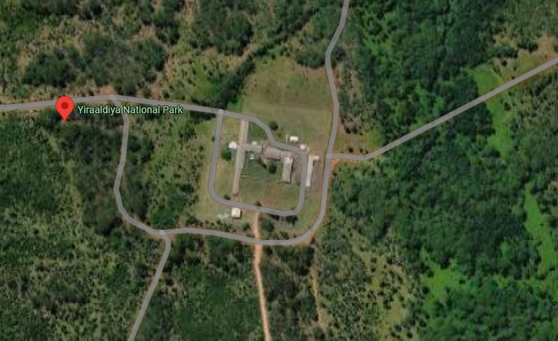
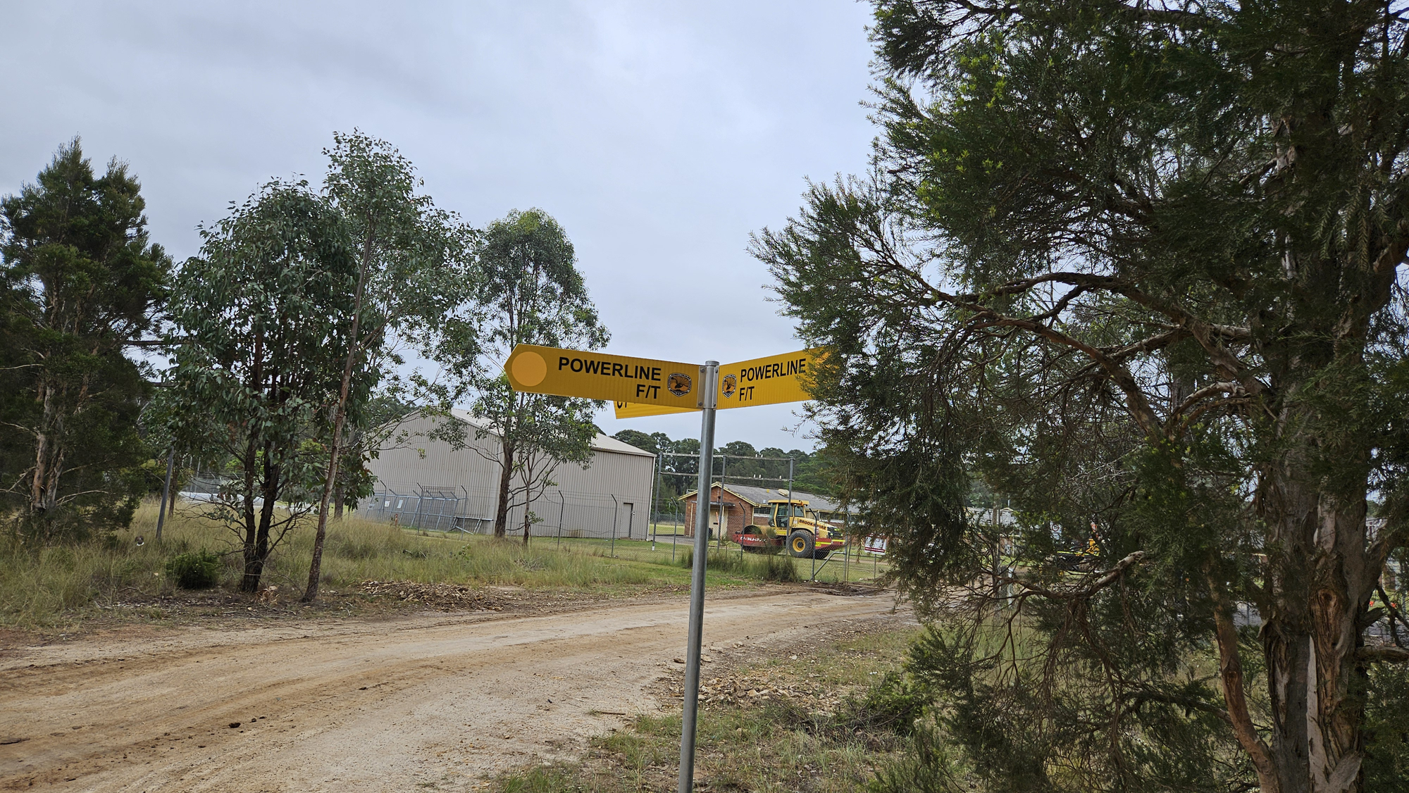
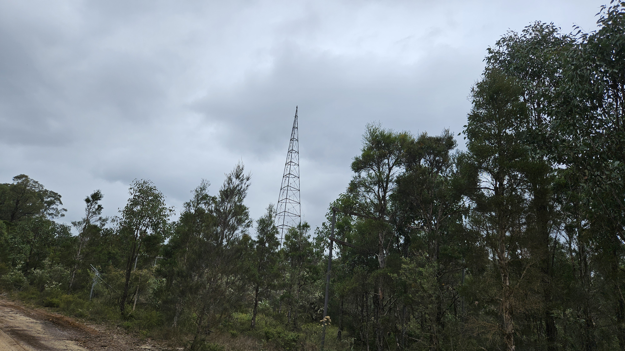
This fenced out area (let's call it Area 52 just for shits and gigs) looked to me like an abandoned farm of some sort. But what all these buildings actually are? Why are there no markings on the map? Why is it in the middle of the bush? And why does it need a radio tower?
Unable to find any information online I came to terms that I might never learn what this complex really is. I'll be forced to forget it, - my mind whispered, - and carry on with my life doing something constructive instead of studying abandoned toilets on Google Maps? That's a tough pill to swallow!
It wasn't until years later, when I was having a casual chat with my workmate who happened to grow up in Shalvey right next to the goddamn bush. We were standing at the back of the place, staring at the edge of a bushland as he was telling me funny stories from late 1980s about riding bikes through Red Road and subsequently having to run away from pegleg. I was surprised by how open he was after years of having rather confrontational attitude towards each other. At that time I was still having night dreams about visiting mysterious Area 52, so I decided to carefully clear the air by asking this man what the hell that place really is.
I'm not yet going to tell you what I heard from him (more on that later), but whatever he said sparked a new wave of interest in me. I set aside my fear of getting mugged by unemployed bushdwellers and firmly decided to explore this ultima thule aka Area 52 to see it myself and get it over with. It's not easy for my mind to carry these little unsolved mysteries.
Exploration
What hides behind a big word of "exploration", in this case, is a simple bush walk. For that I got my mate who kidly agreed to accompany my pseudo-scientific efforts.
North side
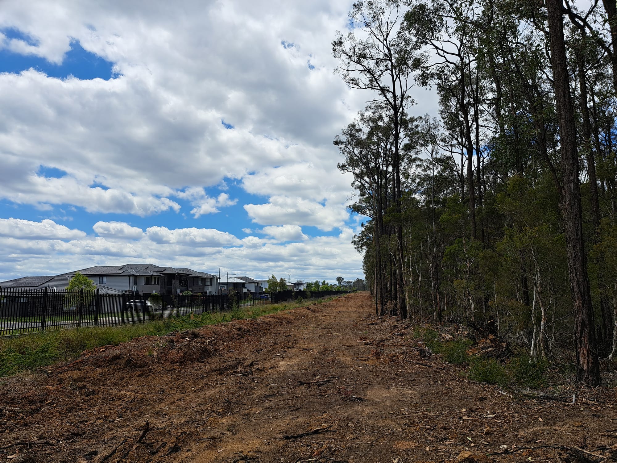
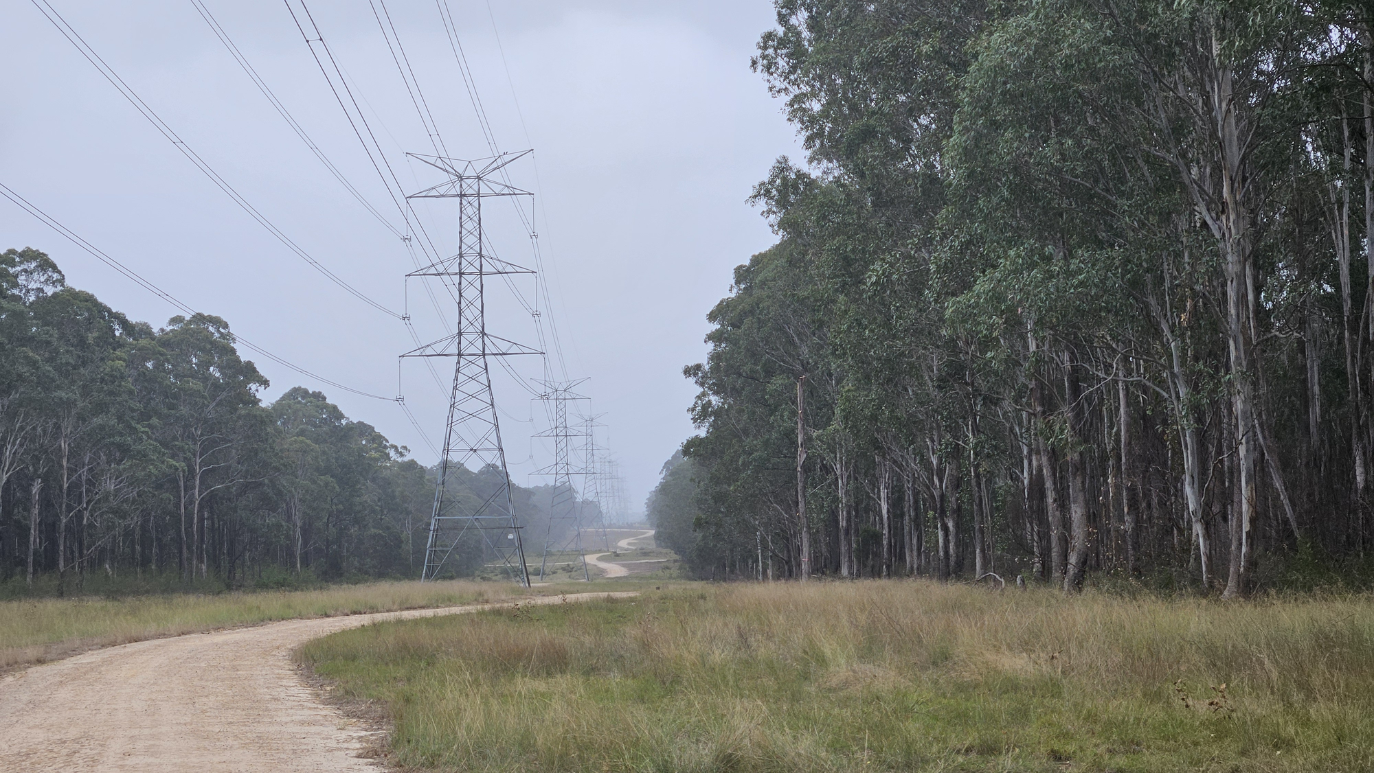
After a quick breakfast we headed towards northern part of the bush only to be met with unexpected obstacle. What used to look like a countrytown bushland only a short time ago is now taking shape of a proper national park:
The transformation is drastic. Less than just a year ago a place looked like this:
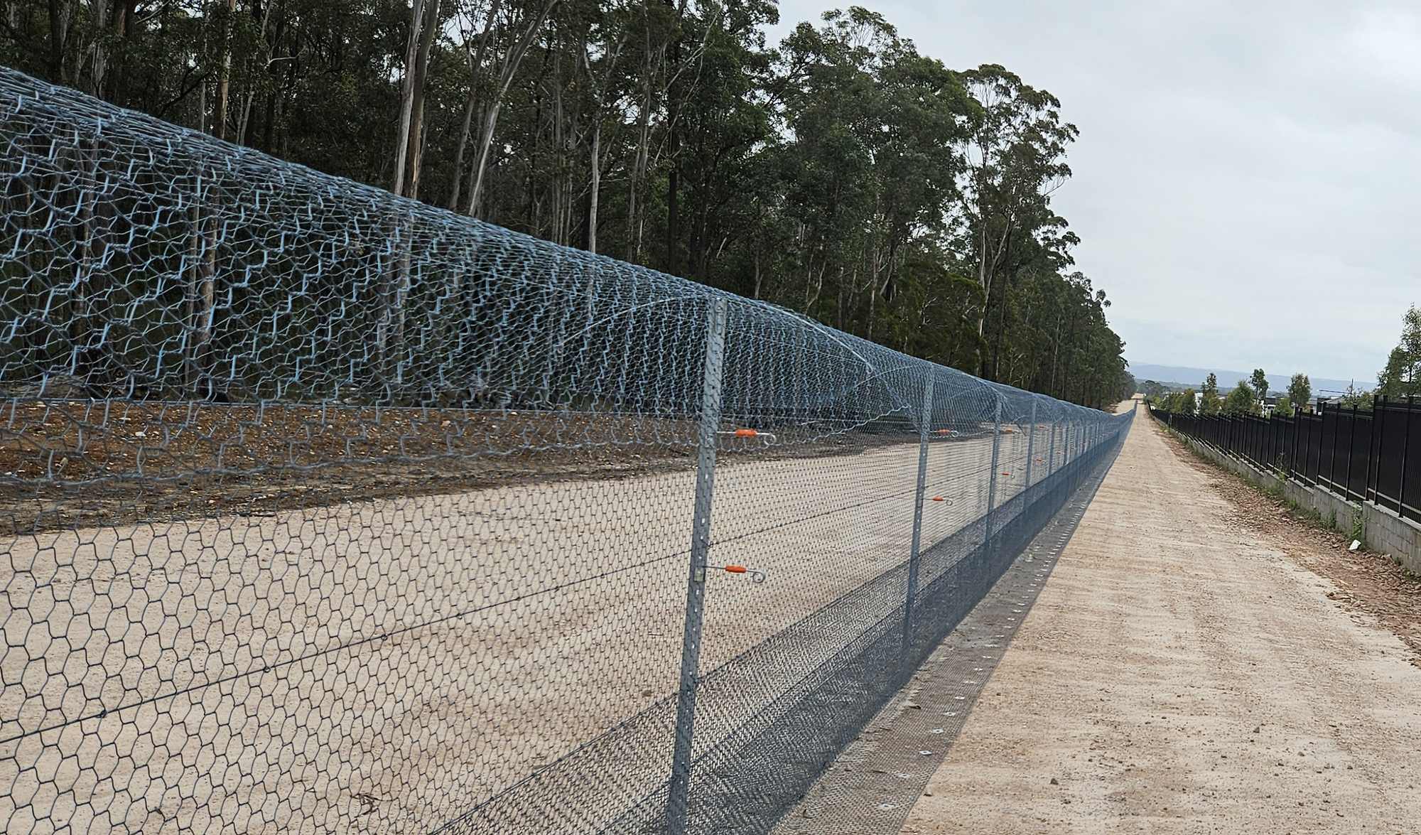
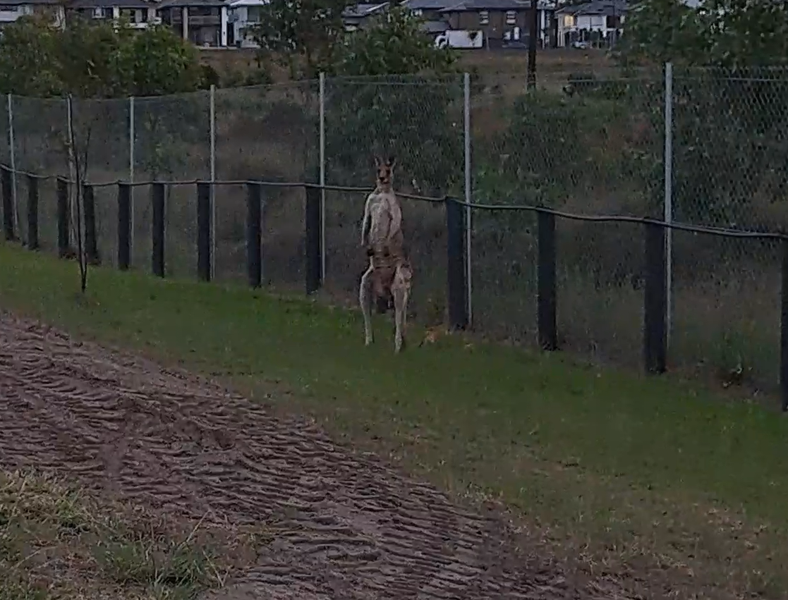
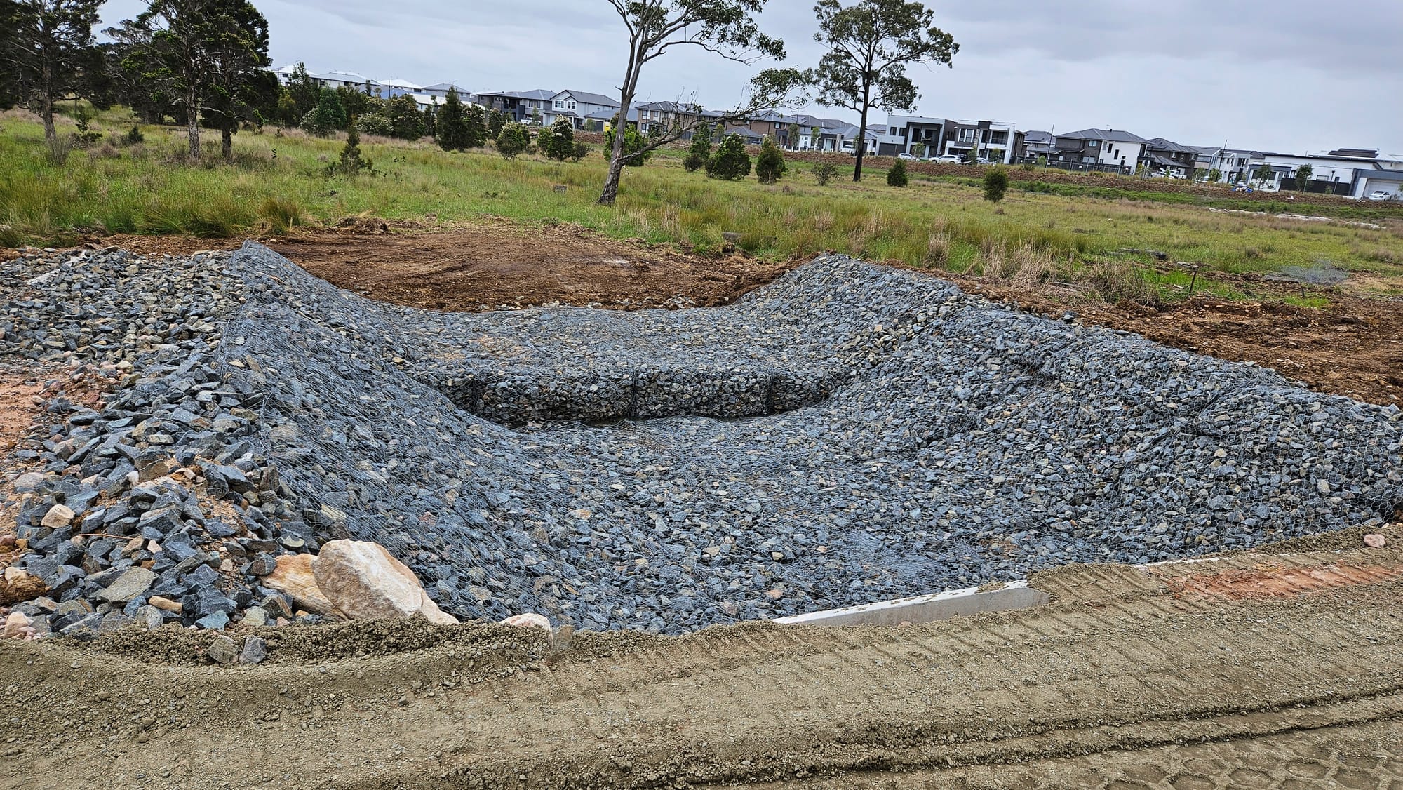
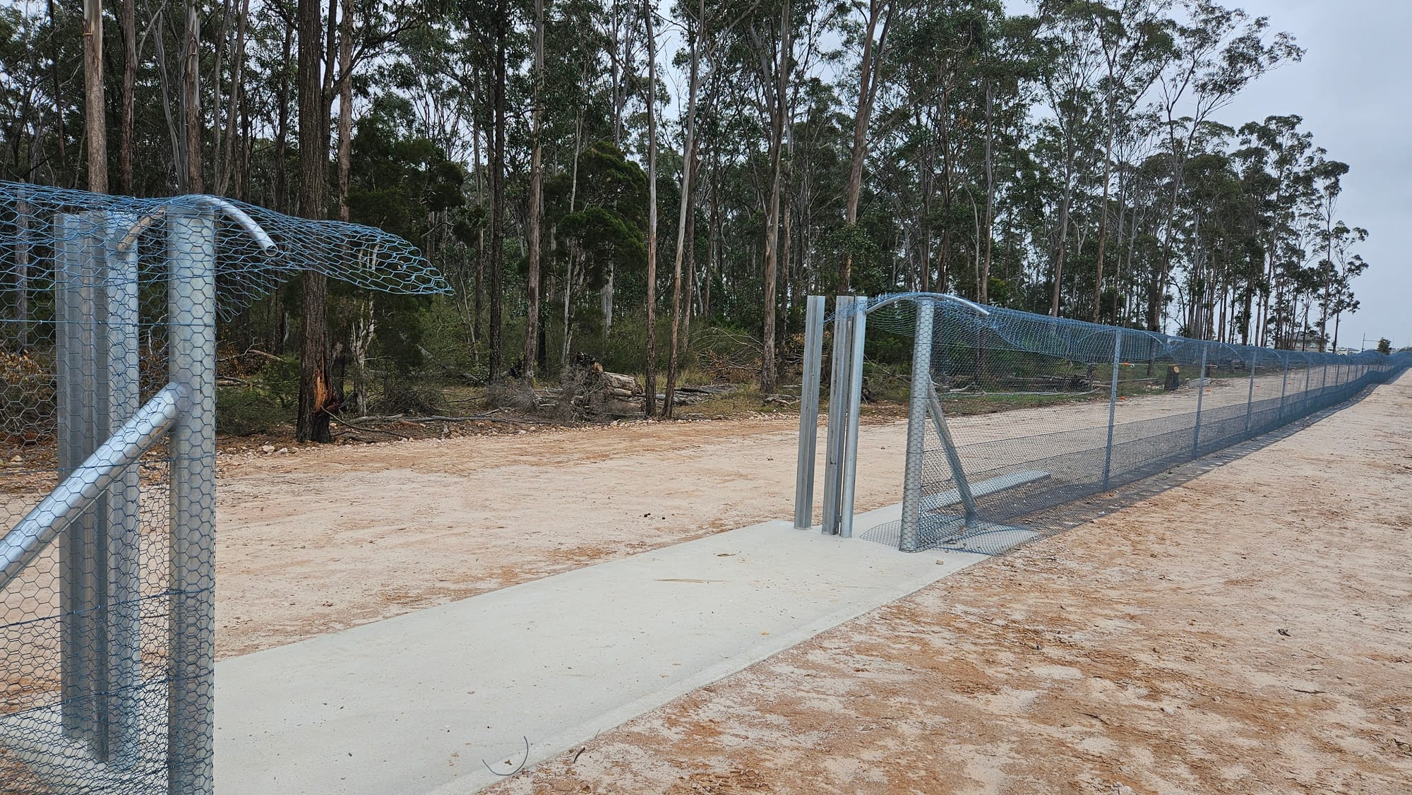
And another year before that (2022) it was still covered in trees with a little firetrail very suitable for mountain biking. Once they began to cut the trees I was convinced they were making room for another street or block of houses. Turns out it's just a new gravel-surfaced trail plus new wildlife fence as a part of national park project and to keep kangaroos away from local streets:
Not being upset with this little inconvenience, we kept on walking along the fence and soon found its end:
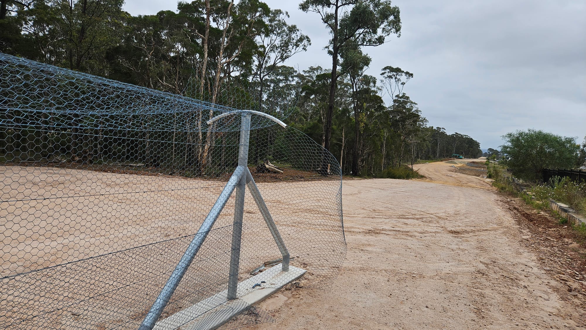
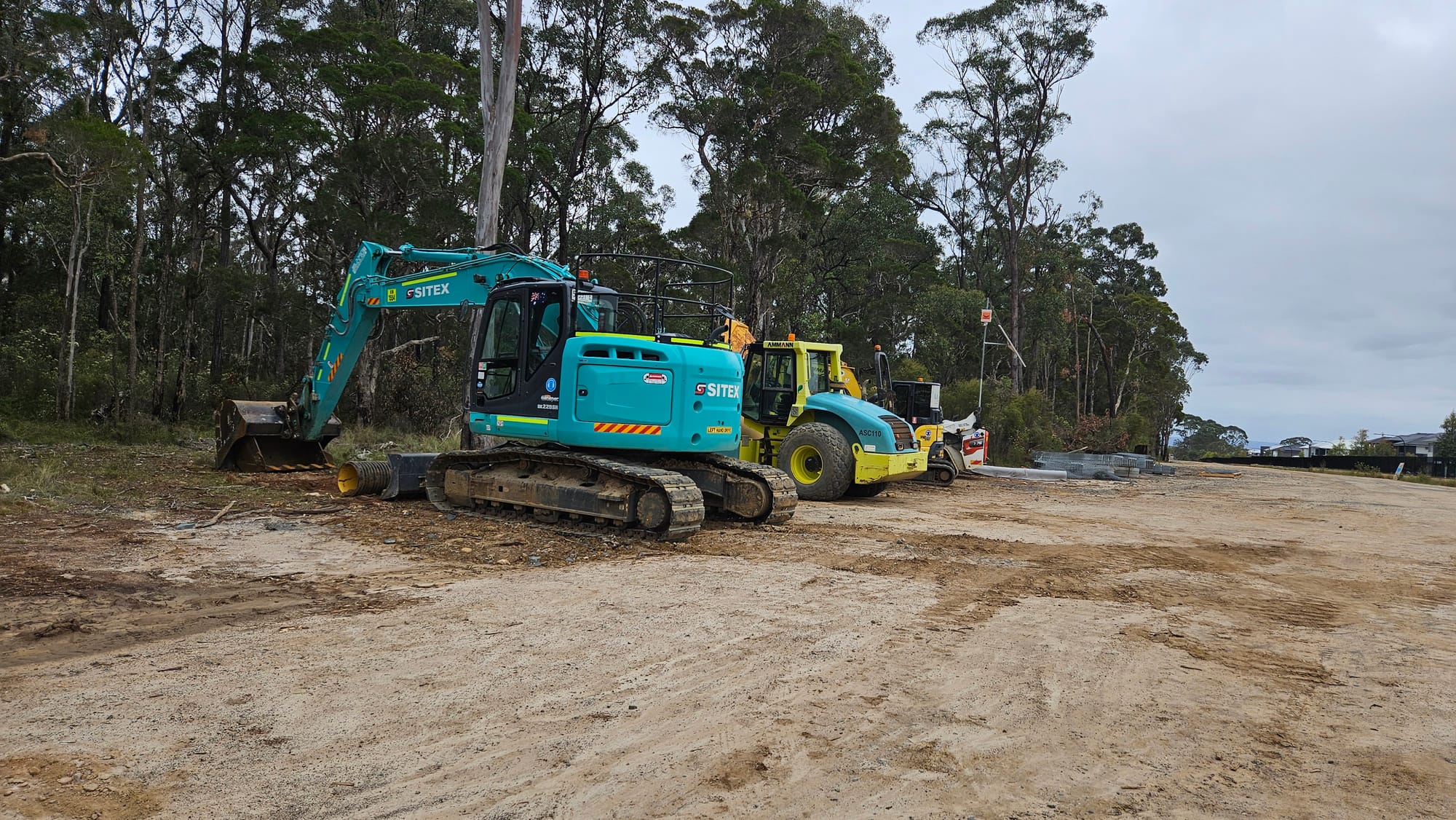
Followed by more construction:
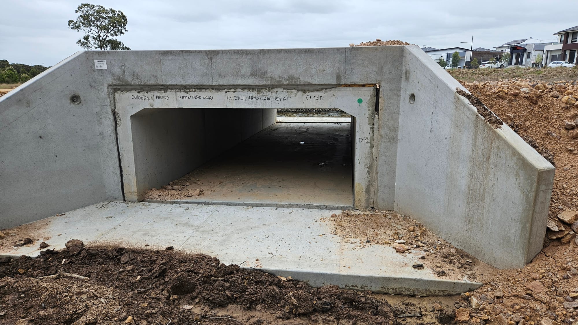
Equipment used:
Turns out they set up a surveillance camera and a siren next to excavators, which went off as we walked past. That's to keep local dropkicks away from machinery which, frankly, wouldn't be very efficient knowing the determination of these characters. Having 24/7 security guard on each of these sites would be too expensive, so I assume that's the best they could do.
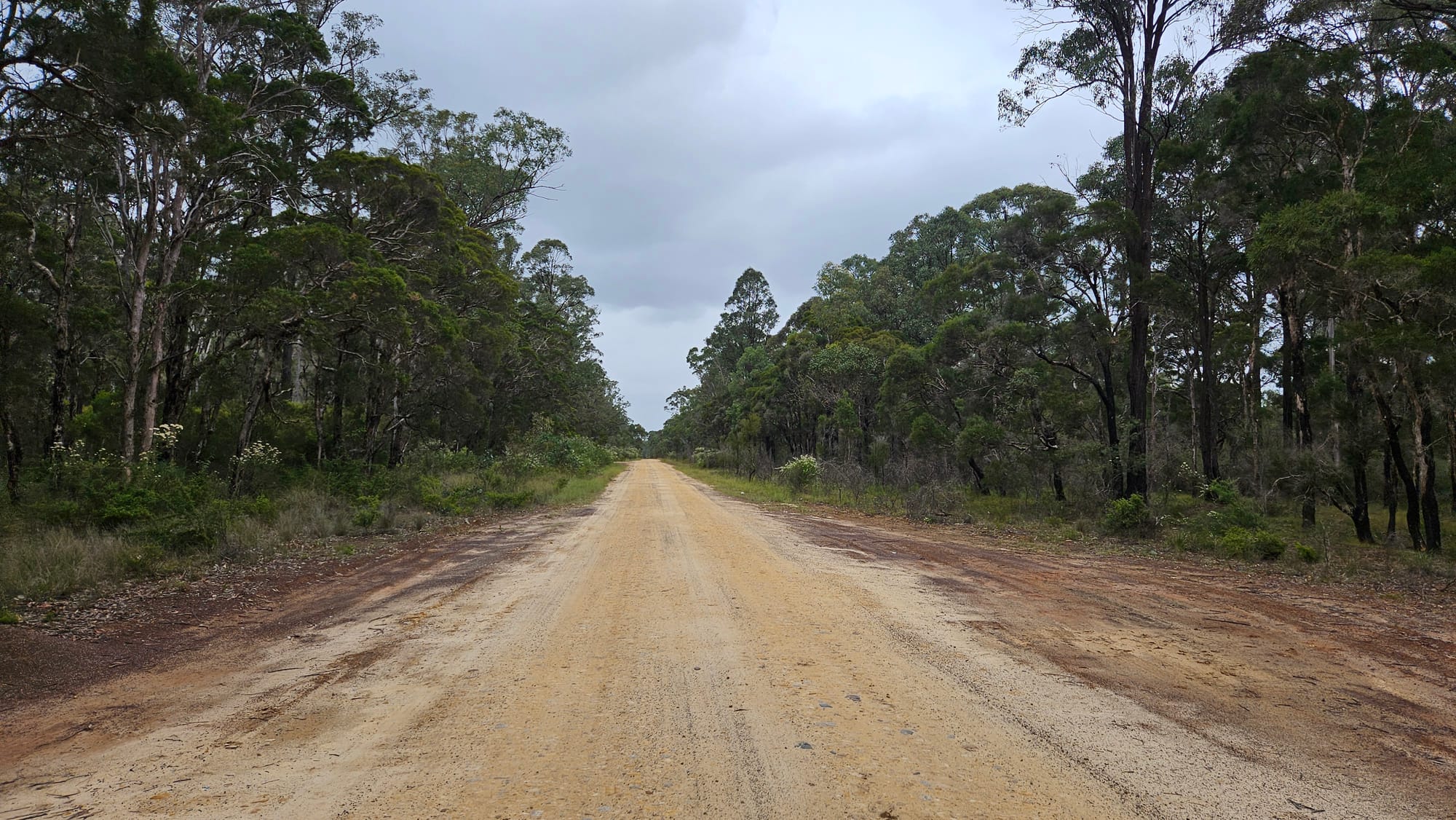
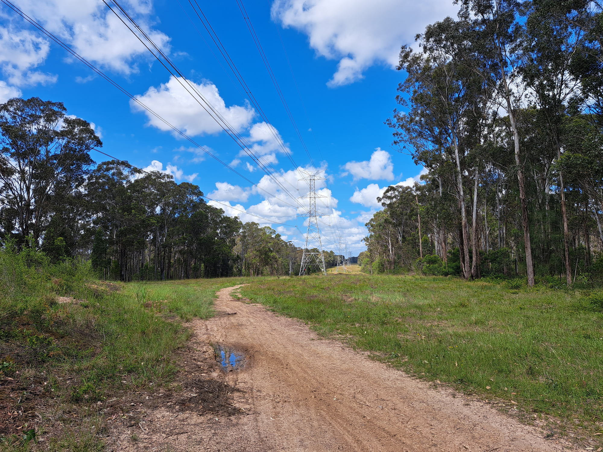
Now we turn left and follow an old firetrail which takes us in southern direction:
Something I haven't captured with my camera is a big number of charred trees along this trail. One might think those are remains from some old bushfire that took place god-knows-when. Others would blame it on 2019-20 black summer. However, people who live locally do remember a big hazard reduction burn that took place in late 2023:
Charred trees is the unfortunate side effect of this much needed operation. Anyway, let's continue along the trail:
As we approached this point I got slightly agitated because the mysterious abandoned public toilet Area 52 was getting dangerously close.
Area 52
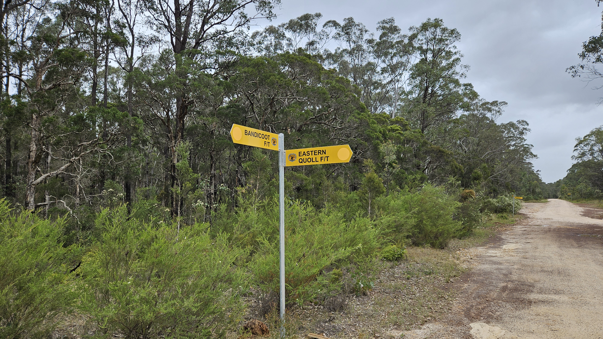
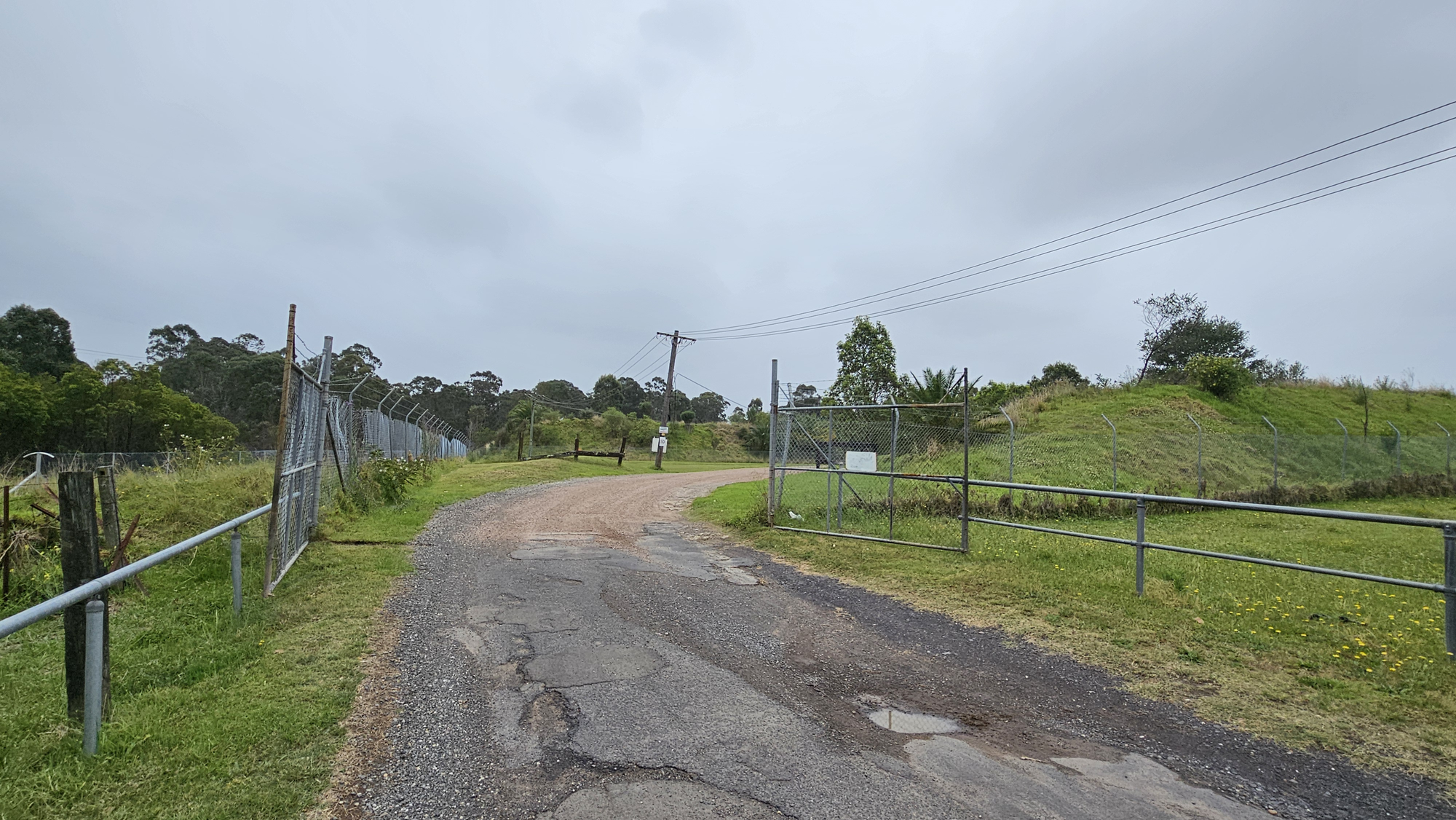
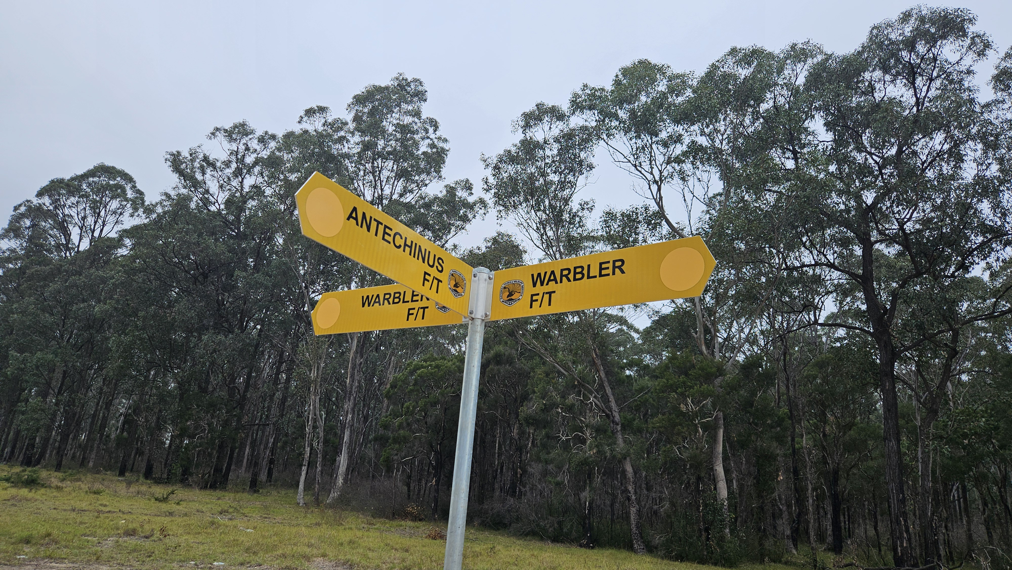
We turned right to what is now called Eastern Quoll firetrail (according to the sign above) which led us towards Area 52:
And here it is, the wondrous place itself:
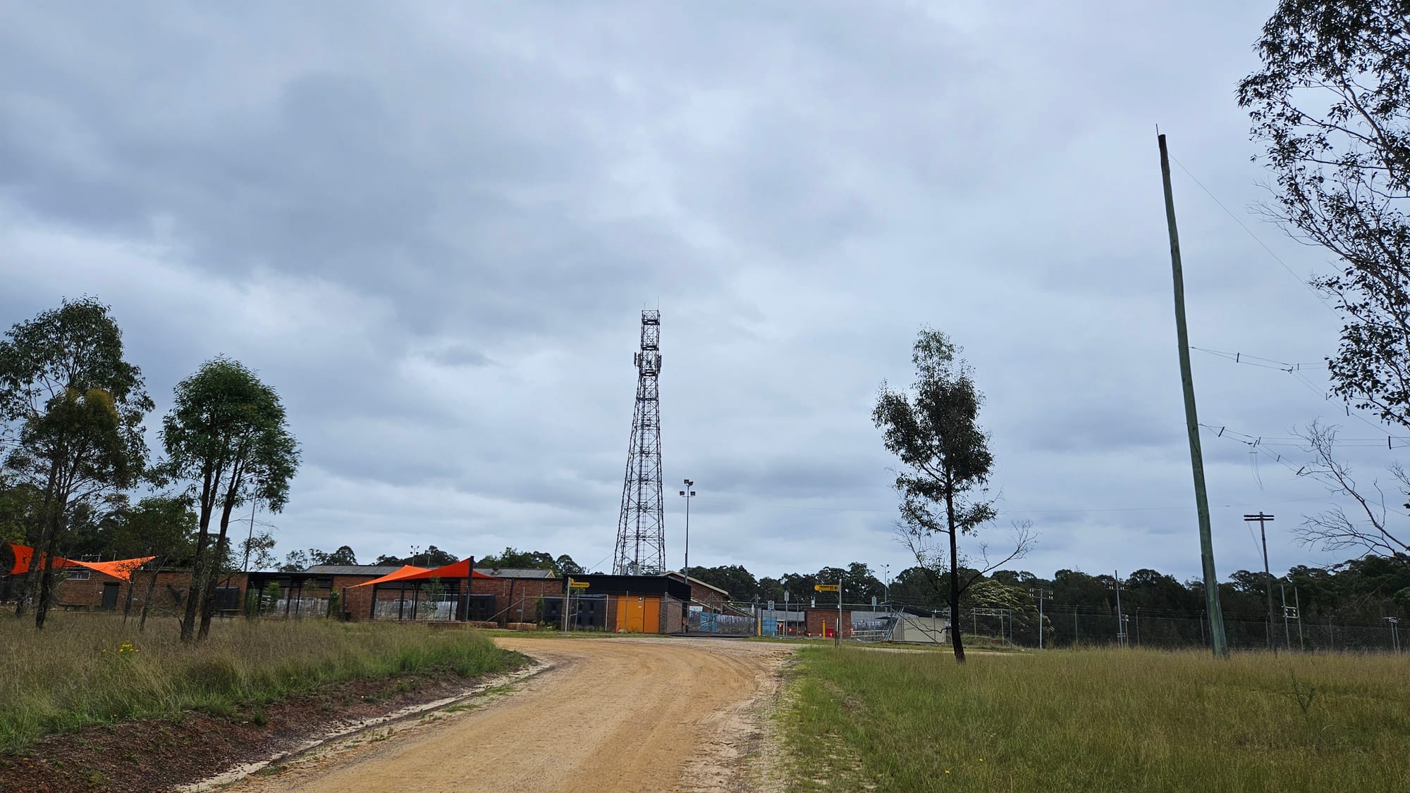
Now we'll pause our journey for a minute since I promised to tell you what I know about this place. According to my workmate, whom I had pleasure to mention earlier in this article, this site is an old RF tower used by RAAF for radio communication. This was confirmed by some users of local Facebook page, but I couldn't find any data to be able to be 100% certain. Until, by a sheer accident, I stumbled on a reddit thread that discussed this very location:
The Llandilo International Transmitting Station is historically significant for its role in the operation of the international air routes to Australia. From 1959 to 2005, the station played a major part in the air traffic control system for international flights to and from this country.
So this is the name of the site, no more 'Area 52' bullshit! My workmate didn't lie, it's an actual transmitting station! He was slightly wrong thinking it was only used by RAAF, when in fact the site played a key role in civil aviation radio communications:
The station, as installed, was the voice of Sydney Aeradio for communicating with aircraft operating to and from Sydney in the South-West Pacific and on overseas flights via Perth and Darwin.
<...> a key link in the chain of HF stations that provided - and provide - long range ground to air radio comms to civilian aircraft.
And of course, it has been decomissioned for about 20 years now according to a fairly recent article:
For most of the twentieth century the site operated as the Llandilo International Transmitter Station for Airservices Australia and its forerunners.
After the transmitters were decommissioned in 2005 the land was transferred to the NSW National Parks and Wildlife Service (NPWS) in 2020.
It makes sense now. Once transmitters stopped transmitting, the process of transmitting transitioning to a national park under NPWS took off. Well, not immediately, more like 15 years later. But still.
I'd like to get deeper into the history of this undoubtedly fascinating place, for instance, how this station accidentally blocked out ABC TV in western suburbs in 1959, or why the hell it was called Llandilo when it's not even in Llandilo. But my essay has already gotten too big to go into these details. I recommend the following articles if you want to learn more:
- The HF Communication Stations of Sydney - story by Ron O’Brien who was in charge of the station between 1969 and 1980.
- Llandilo International Transmitting Station heritage assessment (Page 7) - interesting facts about the station and other heritage sites of Marsden Park.
- Historic Llandilo - DCA HF transmitter site - Secrets of a Sydney past.
- 1946 - VNG Time Signal Station - how Llandilo Station was used for the transmission of Australia's standard time signal between 1993 and 2002.
Another thing worth mentioning is that the RF station buildings are now being turned to a visitor centre as a part of national park project:
A redundant transmitter maintenance shed is redeveloped into an interpretation centre for school programs.
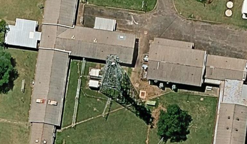
Transmitter maintenance shed? Redundand? Sounds a bit diminishing, doesn't it? Might as well call it a redudand prehistoric sewage tank. This "shed" used to be a proper facility with control room and a rare electronic equipment:
Looks like they even had this "shed" open for visiting at some stage:
Adaptive reuse and development of existing infrastructure to cater to visitors is underway. The visitor precinct is expected to welcome visitors in 2025.
(source)
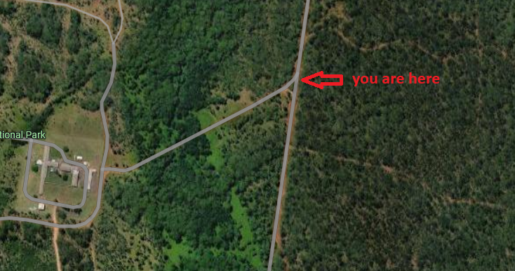
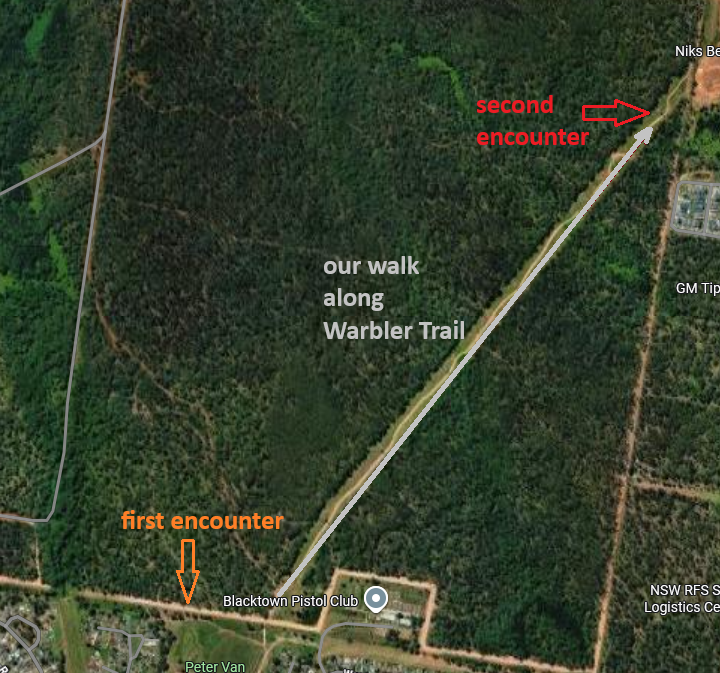
After a brief dive into Area 52 Transmitting Station history we're ready to move on with our little hike. We are now following Powerline Access Trail which is taking us south-west from the main site.
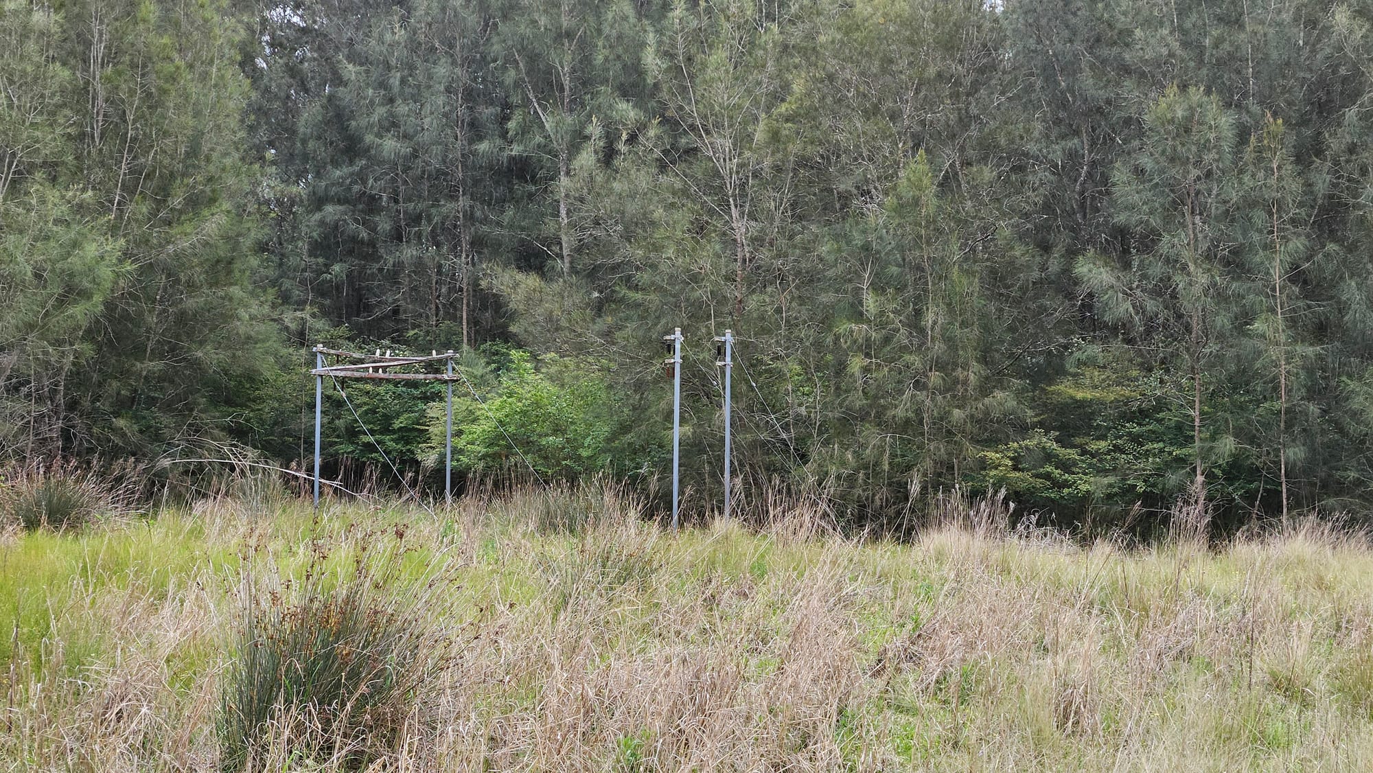
The object captured in the photo is also very interesting. These smaller radio towers are installed in its own fenced out area away from the main site and do form an interesting pattern:
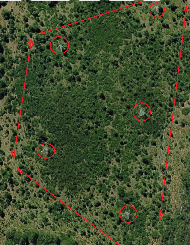
Why did they need these structures when there's already a big-boy-antenna installed on the main site as captured in one of the pictures above? Let's read the fu**ing manual:
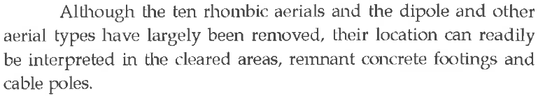
The bulk of the large area of land used was for ten rhombic aerials. These were large diamond shaped antennas supported on 100 foot guyed steel towers and oriented along a major axis, approximately 1,200 feet long, pointing in the direction of the distant station along a great circle path.
Ten? I'm only seeing five on the map, WTF?! Let's go back to fu**ing manual:
So the remains of an old powerline I mentioned above could be what's left of dismantled rhombic aerials aka anthennas? Only Ron O'Brien knows the answer. Also, there's a photo that somewhat manages to capture these beautiful structures:
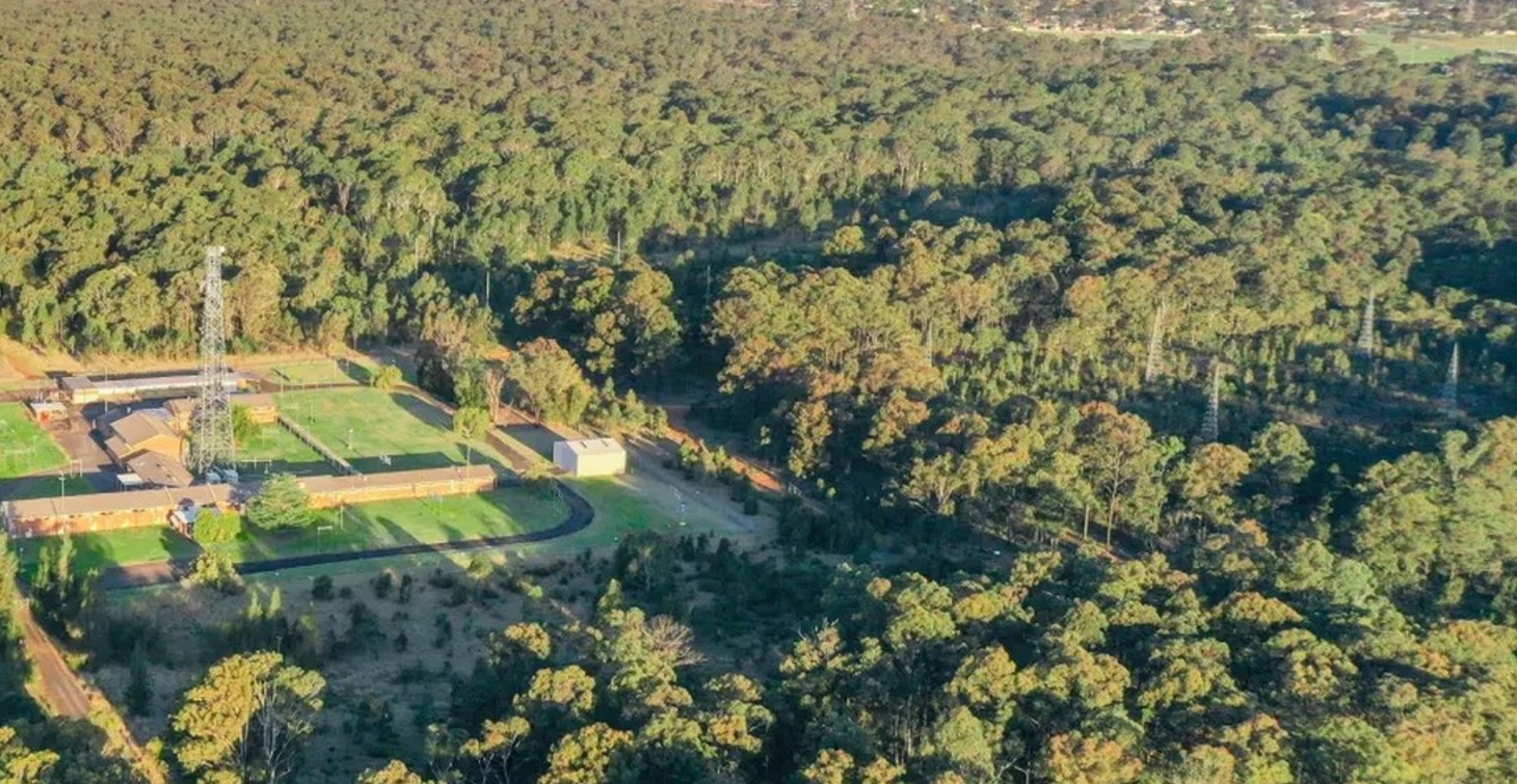
And a drone footage of the whole site. Strangely enough, it doesn't mention anything about Area 52 Transmitting Station.
And with that mystery solved we're moving south, towards lovely and friendly suburb of Willmot.
Southern side
Powerline Access Trail took us further south.
Residential buildings can be seen in the background as we approach south end of the bush:
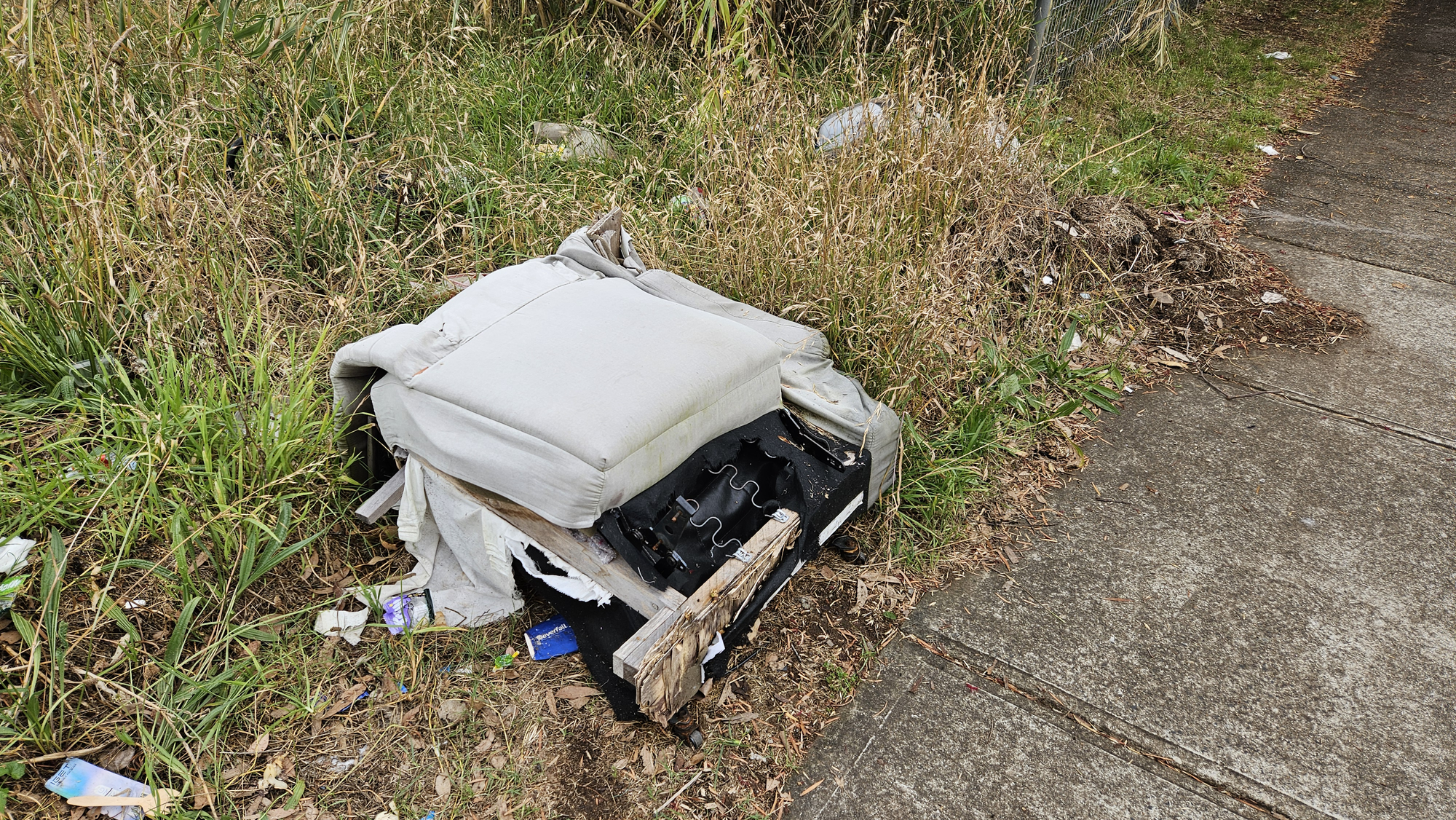
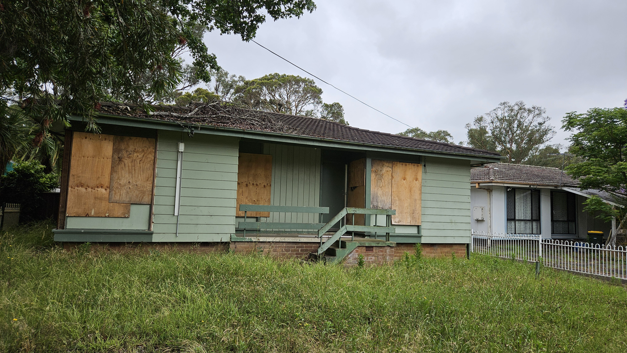
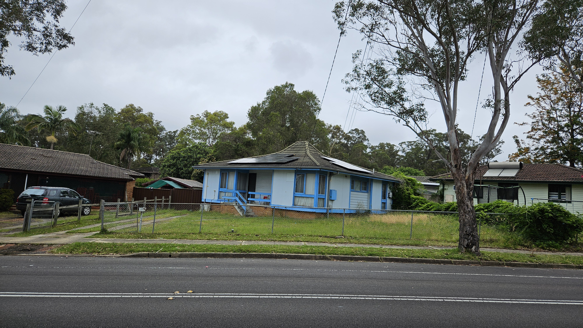
Local streets don't feel dangerous, but aren't very presentable either:
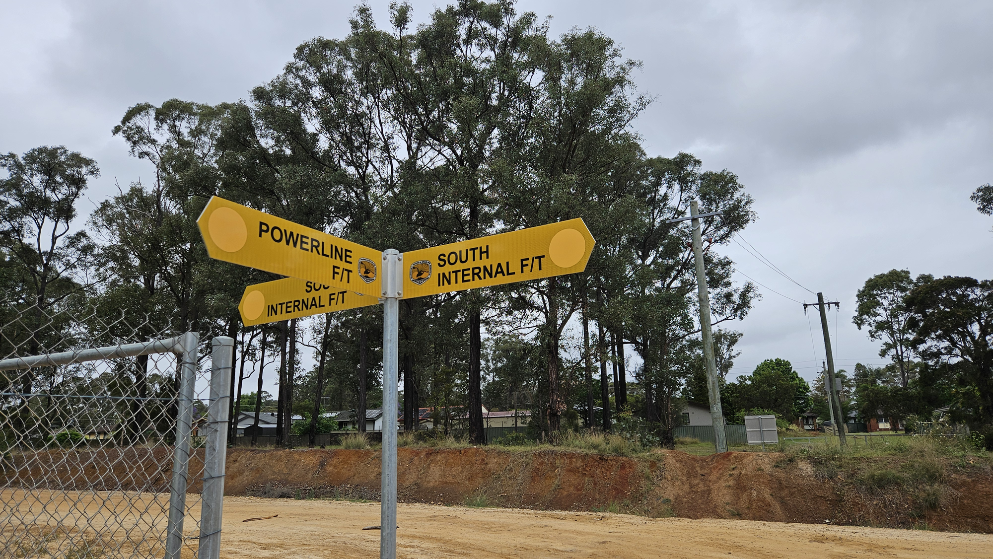
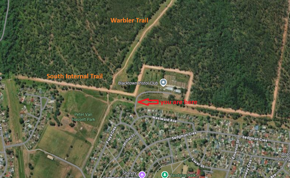
We walked through Captain Cook Drive and other streets adjacent to the bush just to end up at South Internal Trail, right next to the bush again:

Why is it called "internal" when in reality it's rather external relatively to the bush? That's another great secret I'll have to research for.
Meanwhile, we're back to the bush.
Red Road aka Warbler Trail
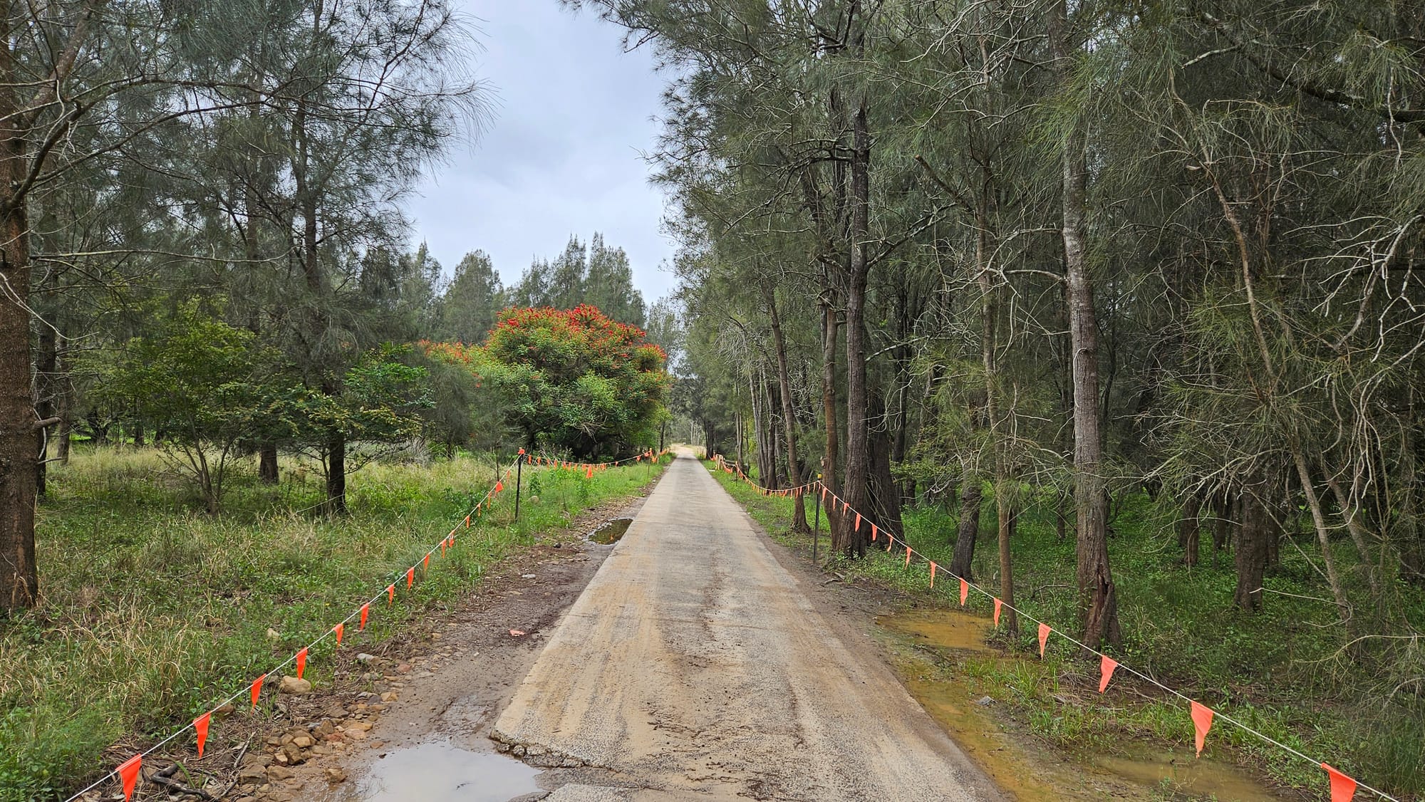
In order to get back to our starting point (Elara) we have to head north via the so-called Red Road, or Warbler Trail as per new developmental plans.
Picture above is what this trail looks like for the most part. Stark contrast to what it was just 2 years earlier if you pay attention to the surface of the trail. These days it's a nice hard-surfaced road as opposed to an abandoned muddy firetrail which it used to be not so long ago:
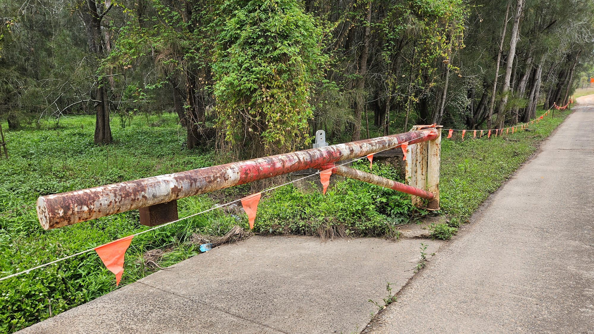
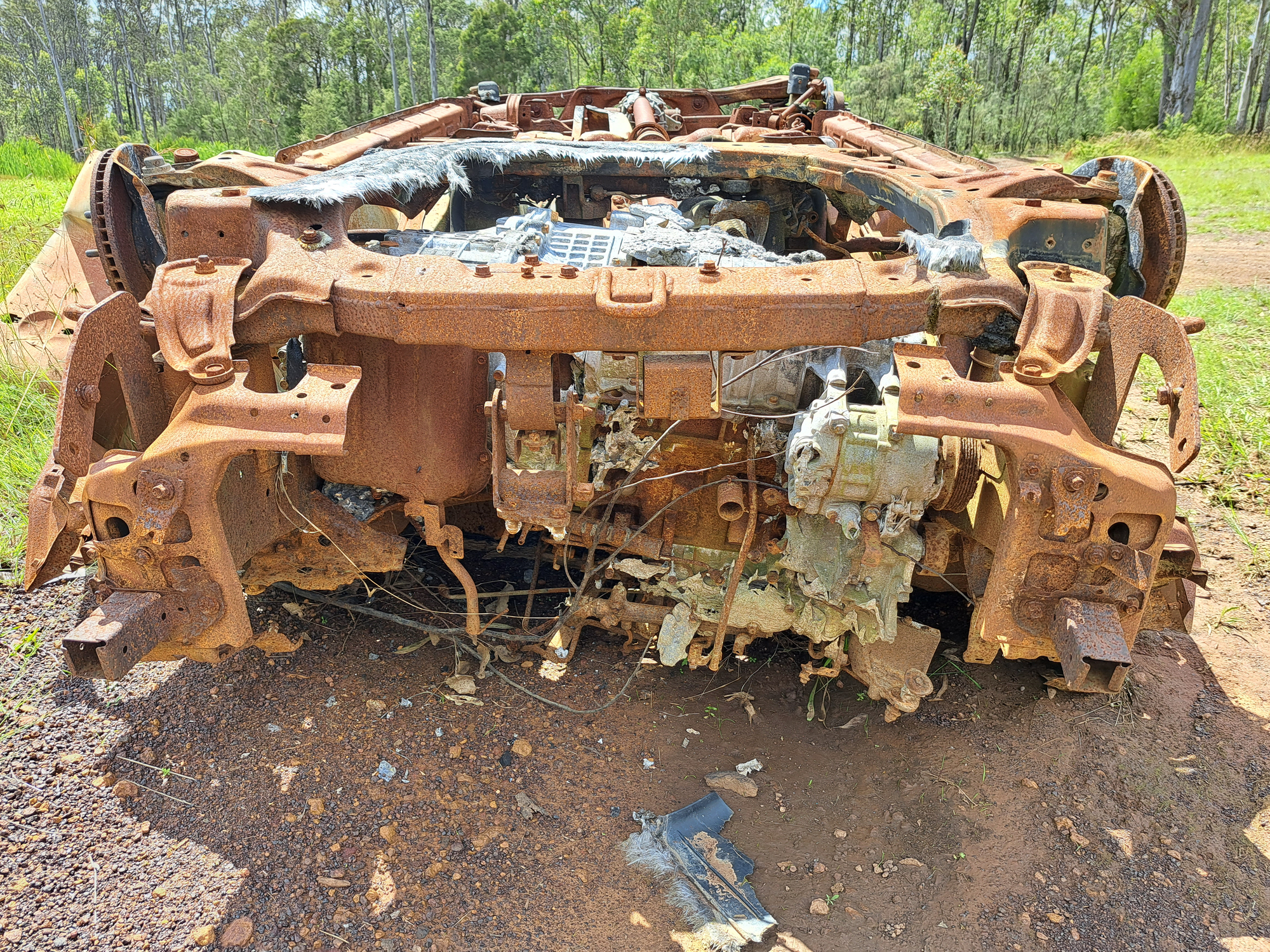
Not only NPWS resurfaced this trail, but they also got rid of some interesting artifacts of a bygone era scattered along the way:
Meanwhile, we continued along the trail.
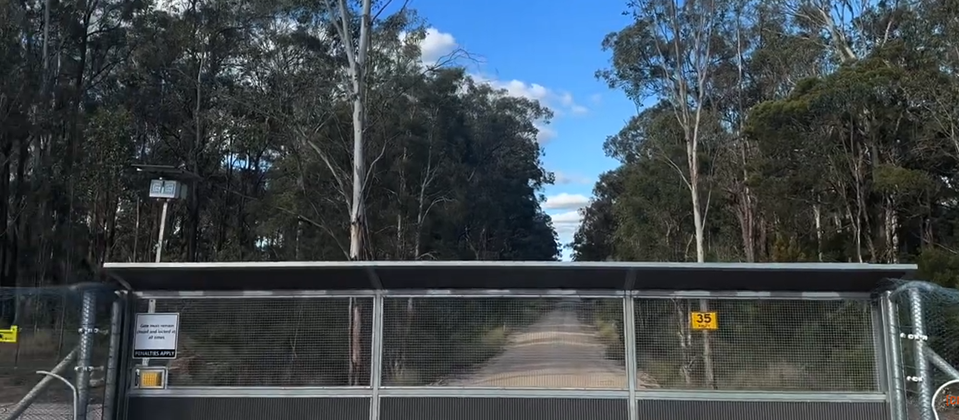
At the north end of Warbler F/T we were met with what used to be an old rusty-wired fence just several years back. Now it's a proper wildlife barrier:
Gap in the middle will be turned into a gate like it's done on the other side of the bush:
And to finish our walk, we have to cross a small section of newly-planted trees which takes us directly to the streets of Elara:
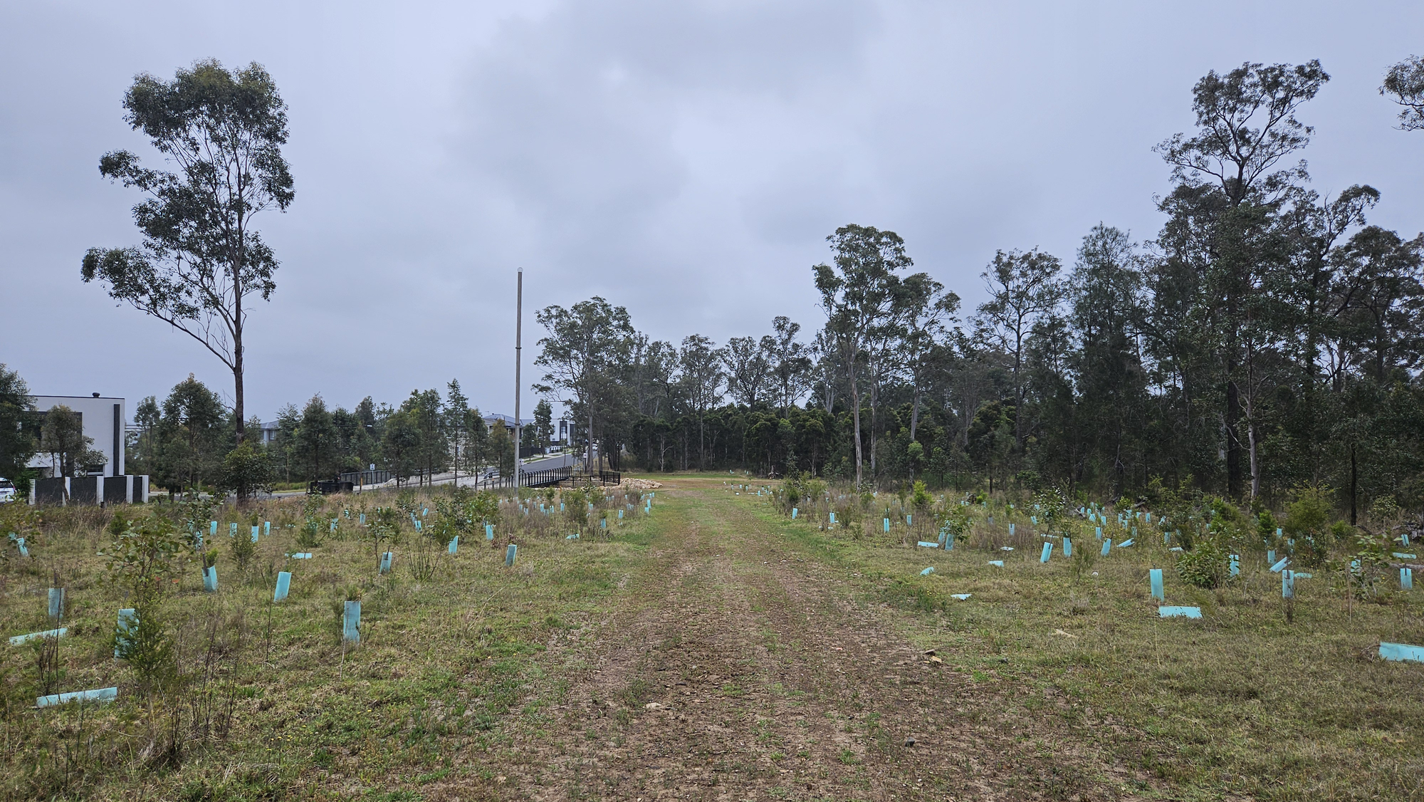
Newly meaning several yeard old, but that's nothing when we talk about trees:
And like this, we're back to where we started. Safe and unscathed. Well, almost.
Sketchy encounter with local mofo
I skipped this little incident in order to avoid distracting a reader from the beauty of an old muddy road national park and its old secrets. However, something happened as we were re-entering the bush from Willmot area in order to make our way back through Warbler F/T.
I noticed a distant figure of a person on a pushbike (later referred to as mofo) about 200m away, pedaling along South Internal Trail towards west. It was the first and only human being we met during the hike. He saw us despite pedaling in the opposite direction, immediately stopped riding and turned his head staring at us as we entered Warbler Trail. Knowing what kind of creatures dwell in these areas (and I don't mean kangaroos) I got slightly suspicious, but didn't say anything to my mate because I didn't want to look like a chicken.
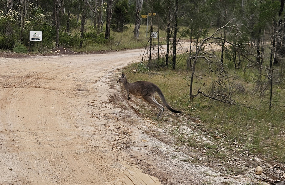
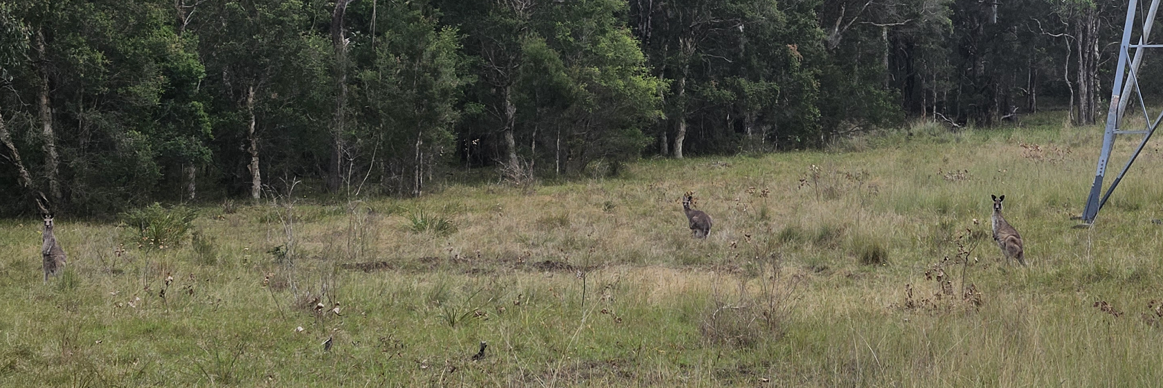
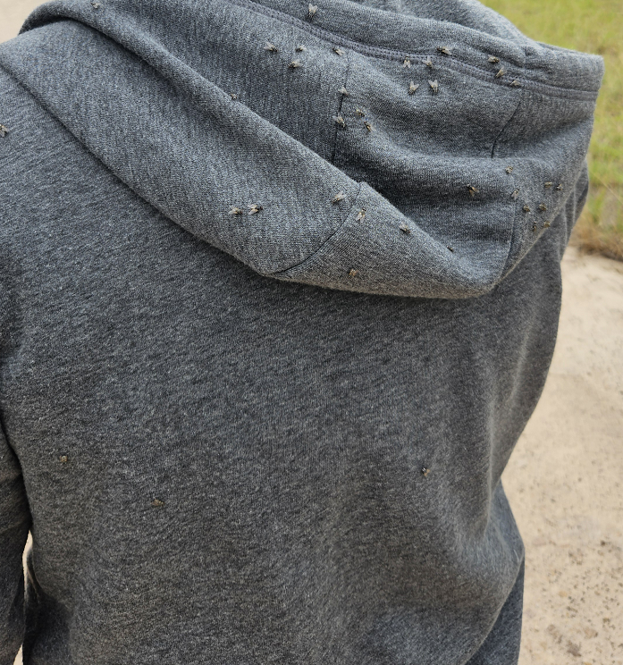
We continued along the trail, watching kangaroos and fighting off the flies while discussing powerlines above our heads and how the thickness of a cable depends on current intensity that runs through it.
When we almost reached northern end of the bush, unexpectedly, I saw the same mofo riding towards us from north-east end of the bush. Not behind us, but from the opposite side of the bushland! Mofo didn't just follow us, this son-of-a-gun made a loop around the area just to catch up with us on the opposite end!
I immediately realized how big of a distance he had to cover in order to catch up which made me feel very uneasy. My mate being an easygoing dude didn't even notice anything suspicious and continued exposing his weak knowledge of electricity while your humble servant quietly began to freak out as this bike-riding freak (pun intended) was getting closer.
Mofo was wearing a cap and a pair of thongs which made an excellent choice for mountain biking out in the bush. He used one hand to steer his bike and carry an eski that was hanging from his shoulder of the same hand. His other hand and this is where I slightly shat my pants was hidden behind his back which made it look like he's carrying a weapon of some sort. And why the f**k do you need an eski while riding your bike around the hood, you dumb c*nt?! Everything about mofo seemed dodgy and somewhat dangerous.
As he rode past he asked "Do you have a cigarette?", which my mate, being a sweet summer child, replied to: "We don't smoke". The eski-carrying-thongs-wearing mofo kept on riding while I was staring at his hand, half of which was still hidden from my sight. What's in his hand? A knife? A pistol? Is he going to mug us or kill us? There's not a single soul around the bush, except for the three of us. If anything happens, chances are police won't even find him. And who would they look for? An idiot riding around a stolen pushbike with an eski in one hand? That's doable, but which area? Bidwill bush? Naaaaah, we got better things to do mate.
Maybe mofo is an up-and-coming rapper who will force us to listen to his lame music about getting rich and driving Lamborghini around the bush Bidwill while forcefeeding us VB and instant noodles from his eski?
Anyway, I kept on staring at his hand as he passed us, and....... there was nothing in it! He held it behind his back just for lulz! Once my mate denied him a cigarette (which is obviously not what mofo was after) he pedaled into the sunset back to Willmot never to be seen again.
Why did mofo go through so much effort chasing us around the bush? He covered 3 km within about 15 minutes. And why did he flank us instead following the same trail which would be twice shorter? Probably didn't want us to notice him. So he want to rob us? Then why did he change his mind? Was it my mate's gangsta appearance that turned him off? Or is it just an unemployed thug from Bidwill area who likes to annoy people? What was in his eski? Drugs? Maybe he's a local dealer who saw us as potential customers? Perhaps, he thought we visited the bush just to buy some devil's lettuce? These questions will remain unanswered and the mystery will perish like the dew an open can of VB under the sun.
Epilogue
Bidwill bush is now slowly transitioning to one of those beautiful national parks that could be found around Greater Sydney Area. Like a smaller version of Royal National Park - vast bushland with a bunch of firetrails and residential buildings at the edge of the park, walking distance away for those who want to see some nature. Despite its questionable reputation, this place is turning into a nice park with a good potential to become a tourist destination which would make for a nice little stop on the way to Blue Mountains or Kurrajong Heights.
NOTE: photos used in this article have been taken in late 2024, unless stated otherwise.
Yiraaldiya National Park further reading: